Category:Maps of archaic Greece
Jump to navigation
Jump to search
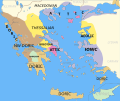
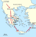
This category contains maps of ancient Greece in the pre-classical or archaic periods
Subcategories
This category has only the following subcategory.
M
Media in category "Maps of archaic Greece"
The following 19 files are in this category, out of 19 total.
-
Alter Orient 0800BC-es.svg 2,102 × 1,510; 3.54 MB
-
Alter Orient 0800BC.svg 2,102 × 1,510; 4.81 MB
-
Alter Orient 0900BC.svg 2,102 × 1,510; 4.93 MB
-
Alter Orient 1000BC.svg 2,102 × 1,510; 4.69 MB
-
Ancient Near East 0800BC.svg 2,102 × 1,510; 4.81 MB
-
Ancient Near East 0900BC.svg 2,102 × 1,510; 4.92 MB
-
Ancient Near East 1000BC.svg 2,102 × 1,510; 4.69 MB
-
AncientGreekDialects Woodard relabelled per Risch.svg 660 × 555; 856 KB
-
Archaic Greece ua.PNG 870 × 747; 112 KB
-
ArchaicGr New.png 653 × 520; 405 KB
-
Dorian inv be.png 542 × 556; 103 KB
-
Grece ages obscurs.svg 1,901 × 1,697; 3.92 MB
-
Grece archaique.svg 1,901 × 1,697; 3.96 MB
-
History of Greece for High Schools and Academies (1899) (14783384143).jpg 3,632 × 2,512; 1.78 MB
-
Map of Archaic Ancient Greece (750-490 BC) (English)v1.svg 994 × 793; 848 KB
-
Map of Archaic Ancient Greece (750-490 BC) (English)v2.svg 2,002 × 1,961; 3.33 MB
-
Map of Archaic Ancient Greece (750-490 BC) (English)v3.svg 994 × 795; 919 KB
-
Map of Archaic Ancient Greece (750-490 BC) (Portuguese)v3.svg 994 × 795; 920 KB
-
Map of Archaic Greece (English).jpg 653 × 520; 356 KB


