Category:Maps of archaeological sites in Tunisia
Jump to navigation
Jump to search
Subcategories
This category has the following 4 subcategories, out of 4 total.
Media in category "Maps of archaeological sites in Tunisia"
The following 28 files are in this category, out of 28 total.
-
Bulla regia apollon.jpg 5,900 × 3,654; 1.55 MB
-
Bulla regia forum.jpg 4,452 × 3,545; 2.11 MB
-
Bulla regia plan.jpg 1,000 × 1,226; 138 KB
-
Castellum Ras el Oued Gordab, 1904.png 1,025 × 668; 276 KB
-
Castellum Ras el Oued Gordab, 1904.svg 923 × 601; 445 KB
-
Haïdra (plan des ruines près de la route de Tebessa) - btv1b8458783m.jpg 4,703 × 7,328; 2.87 MB
-
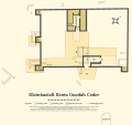
Kastell Benia Guedah Ceder.png 2,953 × 2,395; 303 KB
-
Kerkouane Plan du site 2.jpg 2,969 × 2,155; 2.26 MB
-
Kleinkastell Benia Guedah Ceder, Südtunesien.svg 3,051 × 2,884; 824 KB
-
Late Roman ARS potteries Tunesia.png 3,508 × 2,479; 3.89 MB
-
Maktar plan ruines.jpg 1,086 × 1,635; 67 KB
-
Mididi in the Atlas archéologique de la Tunisie.jpg 1,645 × 3,988; 2.11 MB
-
Mur de Dar el Kous.jpg 1,446 × 2,233; 463 KB
-
Plan de Dar el Kous.jpg 1,561 × 2,365; 956 KB
-
Plan of Utica (1862).jpg 3,156 × 2,424; 4.1 MB
-
Plan site Chemtou, Tunisia.svg 1,883 × 1,282; 199 KB
-
Plan von Chimtou von H. Saladin.jpg 787 × 502; 232 KB
-
Ras Oued el Gordab et Ras el Ain Tlalet, 1904.png 987 × 669; 337 KB
-
Rougga - Plan du forum.svg 3,399 × 3,801; 63 KB
-
Sanctuaire de Thinissut.svg 695 × 850; 29 KB
-
Sanctuaire Thinissut.png 378 × 516; 87 KB
-
Sufeitula.png 2,484 × 3,001; 497 KB
-
Tataouine-ruines 1901.png 478 × 594; 29 KB
-
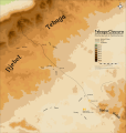
Tebaga-Clausura, Limes Tripolitanus.svg 2,277 × 2,391; 697 KB
-
Tombes de Dar el Kous.jpg 1,567 × 2,326; 479 KB
-
Tunisie carte archéologique.PNG 2,016 × 3,841; 780 KB


