Category:Maps of archaeological sites in China
Jump to navigation
Jump to search
Media in category "Maps of archaeological sites in China"
The following 22 files are in this category, out of 22 total.
-
Map of Eurasia with Xiaohe, Tarim basin and ancient Silk Road routes.gif 778 × 460; 290 KB
-
Map of the Tarim Mummies (Tarim detail).png 2,656 × 1,564; 10.18 MB
-
Map of the Tarim Mummies.png 3,196 × 1,840; 13.92 MB
-
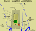
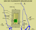
Qin Shi Huang Mausoleum (K9901).png 1,260 × 1,076; 724 KB
-
Qin Shi Huang Mausoleum (Terracotta Army).png 1,260 × 1,076; 725 KB
-
Qin Shi Huang Mausoleum.png 1,260 × 1,076; 725 KB
-
Qin Shi Huanggdi Mausoleum (english).jpg 1,260 × 1,076; 492 KB
-
Qingdongling map.svg 1,314 × 1,035; 34 KB
-
Shirenzigou dwelling F2, with artifacts.png 1,862 × 2,692; 1.77 MB
-
Shirenzigou map.png 2,193 × 1,591; 4.44 MB
-
Shirenzigou mapping.png 2,108 × 1,268; 3.08 MB
-
Ulaanzuukh-Tevsh sites, Deer stones sites and route south to Anyang.png 4,400 × 3,128; 18.25 MB
-
Ulaanzuukh-Tevsh sites.jpg 1,668 × 1,180; 1.3 MB
-
Xichengyi sites.png 4,562 × 3,108; 7.64 MB
-
西夏王陵1号陵.svg 360 × 480; 61 KB
-
西夏王陵2号陵.svg 390 × 510; 69 KB
-
西夏王陵3号陵.svg 390 × 550; 24 KB
-
西夏王陵4号陵.svg 500 × 550; 23 KB
-
西夏王陵5号陵.svg 520 × 700; 59 KB
-
西夏王陵6号陵.svg 480 × 660; 54 KB
-
西夏王陵7号陵.svg 450 × 600; 55 KB


