Category:Maps of ancient Greek cities
Jump to navigation
Jump to search
Subcategories
This category has the following 30 subcategories, out of 30 total.
*
A
- Maps of ancient Alexandria (27 F)
- Maps of Amphipolis (12 F)
- Maps of ancient Argos (5 F)
C
- Maps of Chalkis (8 F)
D
- Maps of ancient Delphi (20 F)
- Maps of Dion (4 F)
- Maps of Dodona (18 F)
E
- Maps of Eleusis (8 F)
- Maps of Eleutherai (4 F)
- Maps of Elis (4 F)
- Maps of Ancient Eretria (2 F)
K
L
- Maps of Laurium (5 F)
M
- Maps of Mantineia (10 F)
- Maps of ancient Megara (6 F)
- Maps of Mystras (6 F)
N
- Maps of Nicopolis of Epirus (10 F)
O
P
- Maps of ancient Pella (11 F)
- Maps of Pergamon (25 F)
- Maps of Philippi (21 F)
- Maps of ancient Pylos (9 F)
S
- Maps of ancient Sparta (34 F)
T
- Maps of Thebes, Greece (15 F)
- Maps and plans of Tiryns (11 F)
Media in category "Maps of ancient Greek cities"
The following 37 files are in this category, out of 37 total.
-
Aigosthena-plan.jpg 800 × 480; 105 KB
-
Archaeological site Minoa on Amorgos description 080428.jpg 2,560 × 2,088; 3.55 MB
-
Archaeological site Minoa on Amorgos map 084954.jpg 3,471 × 2,311; 3.62 MB
-
Minoa Amorgos Map of the overall situation 080430.jpg 2,311 × 3,471; 3.96 MB
-
Amphiareion-plan.jpg 1,050 × 821; 204 KB
-
Ancient Greek & Roman cities in Albania.png 600 × 600; 58 KB
-
Ancient Greek cities-ar.png 1,508 × 1,592; 3.95 MB
-
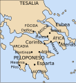
Epamapa.svg 1,434 × 1,554; 36 KB
-
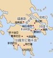
Epammap chinese.png 265 × 288; 44 KB
-
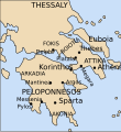
Epammap EL.png 265 × 288; 44 KB
-
Epammap empty.png 265 × 288; 32 KB
-
Epammap-Vectorial1-es.svg 265 × 288; 27 KB
-
Epammap-Vectorial1.svg 265 × 288; 27 KB
-
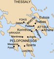
Epammap.png 265 × 288; 48 KB
-
Map Akrotiri 1600 BC-de.png 2,075 × 3,345; 618 KB
-
Map Akrotiri 1600 BC-en.png 2,075 × 3,345; 529 KB
-
Map Akrotiri 1600 BC-fr.png 2,075 × 3,345; 635 KB
-
Map of Lato.jpg 2,956 × 2,460; 2.15 MB
-
Map of Megalopolis in RDCA-ru.png 421 × 397; 82 KB
-
Map of Northern Samos (Bürchner).png 1,702 × 1,176; 2.31 MB
-
Pauly-Wissowa I,2, 1895 Amphiareion.jpg 2,365 × 1,133; 867 KB
-
Pauly-Wissowa III,2, 2079 map.jpg 387 × 731; 82 KB
-
Pauly-Wissowa III,2, 2087 map.jpg 402 × 496; 57 KB
-
Plan Amphipolis-ca.svg 800 × 1,000; 24 KB
-
Plan Amphipolis-en.svg 800 × 1,000; 23 KB
-
Plan Amphipolis-es.svg 800 × 1,000; 24 KB
-
Plan Amphipolis-fr.svg 800 × 1,000; 23 KB
-
Plan Amphipolis-mk.svg 800 × 1,000; 104 KB
-
Plan Amphipolis-ru.svg 800 × 1,000; 26 KB
-
Plan de l'agora d'Antiphellus.jpg 537 × 831; 53 KB
-
Plan de l'agora d'Antiphellus2.jpg 537 × 718; 61 KB
-
Psophis city plan.png 362 × 494; 525 KB
-
Putz100.jpg 800 × 732; 167 KB
-
RE map Assos1.png 788 × 1,016; 285 KB
-
Rhamnus mapEN.png 2,694 × 3,750; 374 KB
-
Seuthopolis City Plan.jpg 451 × 370; 58 KB
-
Tenea 3.jpg 377 × 387; 191 KB


