Category:Maps of ancient Armenia
Jump to navigation
Jump to search
English: This category is supposed to hold maps showing Armenia in ancient times (roughly 300 BCE to 500 AD). This excludes maps of Urartu.
Subcategories
This category has the following 2 subcategories, out of 2 total.
Media in category "Maps of ancient Armenia"
The following 68 files are in this category, out of 68 total.
-
Armenian Empire 80 BC.png 1,084 × 705; 22 KB
-
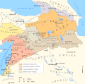
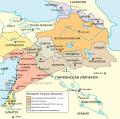
Maps of the Armenian Empire of Tigranes.gif 673 × 669; 56 KB
-
Fenner, Rest. Persis, Parthia, Armenia. 1835 (B).jpg 1,360 × 674; 249 KB
-
Heinrich Kiepert. Asia citerior.Armenia.jpg 2,339 × 2,201; 1.33 MB
-
Alter Orient 0001AD.svg 2,102 × 1,510; 5.05 MB
-
Alter Orient 0100AD.svg 2,102 × 1,510; 4.9 MB
-
Alter Orient 0100BC-af.svg 2,102 × 1,510; 4.77 MB
-
Alter Orient 0100BC-es.svg 2,102 × 1,510; 3.84 MB
-
Alter Orient 0100BC.svg 2,102 × 1,510; 4.77 MB
-
Alter Orient 0200AD.svg 2,102 × 1,510; 4.73 MB
-
Alter Orient 0200BC-es.svg 2,102 × 1,510; 3.64 MB
-
Alter Orient 0200BC.svg 2,102 × 1,510; 4.9 MB
-
Alter Orient 0300AD.svg 2,102 × 1,510; 5.13 MB
-
Armenia Minor map first century BC.jpg 625 × 471; 204 KB
-
Armenia Throughout History.gif 700 × 525; 38 KB
-
Armenia250BC.png 1,000 × 575; 31 KB
-
Armenian Empire-ru.png 1,500 × 850; 187 KB
-
Armenian regions-expansion of the House of Mamikonian-pt.svg 668 × 393; 60 KB
-
Armenian4thcenturies.gif 699 × 456; 49 KB
-
Arsacid (Arshakouni) Armenia, 63-299 A.D..png 700 × 473; 63 KB
-
Arshakid Armenia ARM.JPG 1,280 × 875; 1.01 MB
-
Arshakuni Armenia (hy - հայերեն).png 1,280 × 712; 1.52 MB
-
Arshakuni Armenia 150-ca.svg 2,717 × 1,595; 832 KB
-
Arshakuni Armenia 150-en.svg 2,717 × 1,595; 875 KB
-
Arshakuni Armenia 150-es.svg 2,898 × 1,701; 3.49 MB
-
Arshakuni Armenia 150-fr.svg 2,717 × 1,595; 763 KB
-
Arshakuni Armenia 150-pt.svg 2,717 × 1,595; 1.03 MB
-
ArshakuniArmenia150.png 1,000 × 575; 43 KB
-
Artaxiad Armenia 80BC-fr.svg 2,960 × 2,140; 11.09 MB
-
Artsakh province location map.png 1,893 × 1,080; 251 KB
-
Caucasus03-zh.jpg 874 × 645; 237 KB
-
Caucasus03-zh.png 874 × 645; 43 KB
-
Caucasus03.png 874 × 645; 40 KB
-
Caucasus03.jpg 874 × 645; 54 KB
-
Caucasus03 la.png 874 × 645; 44 KB
-
Caucasus03-es.svg 2,466 × 1,754; 227 KB
-
Caucasus03-sr.png 874 × 645; 41 KB
-
Caucasus Megrelian.jpg 874 × 645; 74 KB
-
Caucasus03 fr.png 874 × 645; 39 KB
-
Caucasus03RO.JPG 874 × 645; 56 KB
-
Armenia in 300 BC.png 850 × 607; 28 KB
-
Caucasus1stcentury-az.png 1,400 × 713; 85 KB
-
Caucasus1stcentury-nolegend-az.png 952 × 713; 59 KB
-
Flag map of the Armenian Empire.png 290 × 193; 19 KB
-
Heinrich Kiepert. Asia citerior.Armenia.II.jpg 1,101 × 854; 256 KB
-
Heinrich Kiepert. Imperia Persarum et Macedonum. 1903 (DB).jpg 851 × 527; 398 KB
-
Heinrich Kiepert. Imperia Persarum et Macedonum. 1903 (EB).jpg 1,323 × 817; 914 KB
-
Imperio Armenio.gif 1,000 × 564; 33 KB
-
Location of Armenian Empire.png 1,427 × 628; 47 KB
-
Map of the Armenian Empire of Tigranes (English).svg 512 × 506; 61 KB
-
Maps of the Armenian Empire of Tigranes-es.svg 1,975 × 1,958; 640 KB
-
Maps of the Armenian Empire of Tigranes-fr.svg 512 × 506; 61 KB
-
Maps of the Armenian Empire of Tigranes-he.svg 512 × 506; 38 KB
-
Maps of the Armenian Empire of Tigranes-pt.svg 512 × 506; 50 KB
-
Maps of the Armenian Empire of Tigranes-ru.svg 512 × 506; 59 KB
-
Near East 0100AD.svg 2,102 × 1,510; 4.87 MB
-
Orontid Armenia -250-en.svg 2,717 × 1,595; 766 KB
-
Orontid Armenia -250-es.svg 2,717 × 1,595; 758 KB
-
Orontid Armenia -250-fr.svg 2,717 × 1,595; 768 KB
-
Orontid Armenia -250-hy.svg 2,717 × 1,595; 757 KB
-
Orontid Armenia -250-pt.svg 2,717 × 1,595; 758 KB
-
Orontid Armenia -250-zh.svg 3,396 × 1,993; 2.51 MB
-
Orontid Armenia.png 1,000 × 575; 42 KB
-
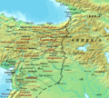
Roman-Persian Frontier, 5th century-zh.svg 1,875 × 1,687; 365 KB
-
Roman-Persian Frontier, 5th century.png 857 × 769; 903 KB
-
Yervanduni Armenia, IV-II BC.gif 700 × 457; 58 KB
-
Zakavkaz-II-I-bc.png 930 × 698; 276 KB
-
Армения.png 673 × 669; 105 KB


