Category:Maps of air routes
Jump to navigation
Jump to search
Subcategories
This category has the following 3 subcategories, out of 3 total.
Media in category "Maps of air routes"
The following 135 files are in this category, out of 135 total.
-
10 longest non-stop flights March 2016.gif 720 × 360; 21 KB
-
1925 Air Routes in Asia Minor and Iraq.jpg 1,243 × 851; 281 KB
-
1925 Air Routes in Indochina.jpg 1,233 × 1,572; 423 KB
-
1925 Air Routes in Western Anatolia.jpg 653 × 921; 159 KB
-
1925 Air Routes of Australia.jpg 1,659 × 1,201; 559 KB
-
1925 Air Routes of Brazil and Uruguay.jpg 1,971 × 593; 416 KB
-
1925 Air Routes of British India.jpg 1,224 × 639; 216 KB
-
1925 Air Routes of Central America.jpg 869 × 599; 164 KB
-
1925 Air Routes of China.jpg 595 × 859; 202 KB
-
1925 Air Routes of Colombia and Ecuador.jpg 1,269 × 1,660; 535 KB
-
1925 Air Routes of Egypt.jpg 580 × 851; 192 KB
-
1925 Air Routes of France.jpg 1,609 × 1,237; 540 KB
-
1925 Air Routes of French Guiana.jpg 961 × 586; 209 KB
-
1925 Air Routes of Hawaii.jpg 916 × 586; 237 KB
-
1925 Air Routes of Japan.jpg 1,181 × 1,751; 802 KB
-
1925 Air Routes of Mexico.jpg 921 × 592; 201 KB
-
1925 Air Routes of New Zealand.jpg 1,219 × 1,756; 764 KB
-
1925 Air Routes of Newfoundland and Nova Scotia.jpg 591 × 857; 242 KB
-
1925 Air Routes of Persia.jpg 1,246 × 855; 284 KB
-
1925 Air Routes of Peru.jpg 562 × 595; 125 KB
-
1925 Air Routes of South Africa.jpg 1,237 × 1,000; 350 KB
-
1925 Air Routes of Switzerland.jpg 1,779 × 1,231; 463 KB
-
1925 Air Routes of the Belgian Congo.jpg 946 × 595; 158 KB
-
1925 Air Routes of the Dutch East Indies.jpg 960 × 592; 286 KB
-
1925 Air Routes of the Philippines.jpg 897 × 587; 261 KB
-
1925 Air Routes of Tunisia.jpg 284 × 878; 115 KB
-
1925 Map of Air Routes in Germany.jpg 1,752 × 1,229; 587 KB
-
1925 Route Map of Scandinavia and the Baltic States.jpg 1,260 × 746; 338 KB
-
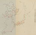
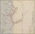
1937年的臺北(臺北飛行場)-那霸-福岡民航路線圖 Airline Map of Taipei - Naha - Fukuoka.jpg 570 × 185; 104 KB
-
Air Routes from KLIA.PNG 859 × 570; 51 KB
-
Air Routes in Alaska in 1925.jpg 551 × 601; 129 KB
-
Air Routes of Chile in 1925.jpg 575 × 589; 143 KB
-
Air Routes of Great Britain.jpg 1,235 × 1,412; 594 KB
-
Air Routes of Quebec, Ontario, and New York in 1925.jpg 601 × 857; 175 KB
-
Air Routes of the United States in 1925.jpg 1,798 × 1,143; 497 KB
-
Air Routes of the West Indies in 1925.jpg 876 × 596; 228 KB
-
Airline hub-1995 mk.svg 410 × 175; 96 KB
-
Airline hub-1995.svg 410 × 175; 24 KB
-
Avianca Express Routes.gif 540 × 540; 17 KB
-
Avianca Routes from AILA - Guatemala.gif 540 × 540; 21 KB
-
Aviation in Albania in 1925.jpg 282 × 897; 72 KB
-
Avolar Routemap 110507.jpg 1,530 × 1,967; 711 KB
-
Baggage carousel (Barcelona) in 2021.02.jpg 4,160 × 3,120; 3.32 MB
-
Bdl.gif 720 × 360; 19 KB
-
Bell telephone magazine (1922) (14756454475).jpg 2,864 × 1,804; 873 KB
-
Boliviana de Aviación - International Destinations.gif 540 × 540; 16 KB
-
Central America Flight Routes to the Americas.gif 540 × 540; 31 KB
-
Direct Flights from Japan (Nov 2023).png 3,230 × 1,701; 925 KB
-
Direct versus non-stop flight illustration.gif 720 × 360; 15 KB
-
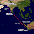
Double Sunrise Route.gif 540 × 540; 53 KB
-
Dubroff map.jpg 1,990 × 1,250; 314 KB
-
Ecuador - Aerogal Domestic Routes.gif 720 × 360; 11 KB
-
Ecuador - Aerogal International Routes.gif 540 × 540; 17 KB
-
El Salvador Flight Routes.gif 540 × 540; 26 KB
-
EMA Europe, North Africa destinations, 11-2013.png 538 × 511; 70 KB
-
Enroute-Chart Arizona-Nevada ENR L08, 2024.jpg 22,000 × 8,000; 2.47 MB
-
Europe-hu-Malev-destinations.svg 506 × 670; 1,018 KB
-
Europeisk lufttrafik 1924, Nordisk familjebok.png 1,117 × 748; 47 KB
-
France, Morocco, Algeria, and Senegal Route.jpg 592 × 1,745; 267 KB
-
Frankfurt airport hub map v2.png 1,158 × 909; 1.03 MB
-
From china to na.png 882 × 918; 1.04 MB
-
Grafik gabelflug.png 700 × 711; 56 KB
-
Grafik gabelflug2.png 700 × 711; 151 KB
-
Guatemalan international air routes in the Americas.gif 540 × 540; 26 KB
-
Imperial routes April 1935.jpg 1,233 × 940; 391 KB
-
In flight tracking.JPG 4,724 × 2,654; 6.39 MB
-
International flight routes within Central America.gif 720 × 360; 24 KB
-
Isla de Pascua (2008).jpg 2,056 × 1,258; 551 KB
-
Japanese airlines in 1936.jpg 4,465 × 2,465; 1.21 MB
-
Japanese airlines in 1937.jpg 3,097 × 3,009; 1.22 MB
-
Japanese airlines in 1939.jpg 3,153 × 3,065; 1.37 MB
-
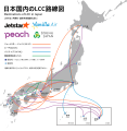
Japanese LCC destinations map.svg 590 × 605; 700 KB
-
Japanese LCCs RouteMap.png 2,400 × 2,800; 910 KB
-
JNB.svg 1,052 × 744; 25 KB
-
KATW Destinations.gif 720 × 360; 20 KB
-
KCAK Destinations.gif 720 × 360; 17 KB
-
KCID Destinations.gif 720 × 360; 25 KB
-
KGEG Domestic Passenger Destinations.gif 720 × 360; 19 KB
-
KMLI Destinations.gif 720 × 360; 22 KB
-
KMVY Destinations map.gif 720 × 360; 14 KB
-
KTTN Destinations.gif 540 × 540; 23 KB
-
Long Haul Flights OR TAMBO.svg 1,427 × 628; 24 KB
-
Long Haul Flights Tambo.svg 1,427 × 628; 63 KB
-
Longest Domestic Flight - Great Circle Route - PPT-CDG.gif 720 × 360; 18 KB
-
Longest Non-stop Flights From Guatemala City - AILA.gif 720 × 360; 18 KB
-
Malaysia air routes.PNG 600 × 616; 117 KB
-
Map Airlines PapuaNG.jpg 945 × 666; 281 KB
-
Map of Central America flights to Europe.gif 720 × 360; 27 KB
-
Map of Central America flights.gif 540 × 540; 38 KB
-
Map of European Air Routes in 1925.jpg 1,788 × 1,236; 459 KB
-
Map of Qantas International Routes as of December 2023.png 720 × 360; 69 KB
-
Mapa de Rutas Aéreas desde el Aeropuerto Internacional la Aurora.gif 540 × 540; 21 KB
-
Mexico-Guatemala Air Routes.gif 720 × 360; 56 KB
-
Network AirOne (Estate 2010).gif 720 × 360; 70 KB
-
NIMBY-bos.jpg 900 × 613; 94 KB
-
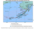
North-Pacific-air-routes.png 500 × 441; 34 KB
-
Open-jaw scheme.svg 600 × 400; 411 KB
-
Original Wallaby Route Qantas 1952.gif 720 × 360; 13 KB
-
OSAS route map.svg 1,410 × 715; 1.13 MB
-
Pioneers of the World's Aerial Highways.jpg 2,067 × 1,271; 1.38 MB
-
PIT Destination Map - 2010.png 1,477 × 1,002; 1,002 KB
-
Ram connexions to main hubs.jpg 709 × 358; 73 KB
-
RDU Domestic Destinations.gif 720 × 360; 24 KB
-
Regie Malgache route map.png 464 × 328; 105 KB
-
Rockhampton (2009) 02.jpg 2,640 × 4,122; 9.84 MB
-
Route Map 1936.jpg 1,181 × 1,491; 1.73 MB
-
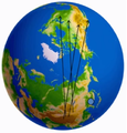
Route plane on earth GFDL.jpg 640 × 296; 33 KB
-
Silver Routes.jpg 3,300 × 2,550; 1.08 MB
-
SJU Mainland Destinations December 2021.gif 540 × 540; 36 KB
-
South Atlantic air routes WWII.png 519 × 401; 85 KB
-
Southatlanticoute.jpg 685 × 296; 61 KB
-
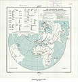
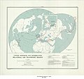
The World areas covered by Commercial Air Routes.jpg 2,070 × 1,290; 1.1 MB
-
United Kingdom and Portugal Bilateral Air Transport Rights, 1947.jpg 6,912 × 5,946; 4.62 MB
-
United States of America and the United Kingdom Bilateral Air Transport Rights, 1947.jpg 12,036 × 7,048; 5.39 MB
-
VNA2.jpg 1,298 × 804; 90 KB
-
Volaris Costa Rica Routes.gif 540 × 540; 16 KB
-
Voos internacionais de CNF em 11-2016.gif 540 × 540; 44 KB
-
Voos nacionais de CNF em 11-2016.gif 540 × 540; 78 KB
-
Weltumrundung Elly Beinhorn.jpg 2,339 × 1,169; 1.6 MB
-
Western Canada, Washington, Montana, and Washington 1925 Air Routes.jpg 596 × 1,410; 211 KB
-
Westray to Papa Westray air route map.png 667 × 856; 192 KB
-
World air routes, 1958.jpg 5,545 × 4,181; 3.21 MB
-
World airline routes.png 4,000 × 1,850; 2.75 MB
-
World flight routes.png 3,783 × 3,753; 8.34 MB
-
World-airline-routemap-2009.png 2,048 × 1,025; 2.43 MB
-
World-airline-routemap-2010.ogv 12 s, 1,024 × 1,024; 34.79 MB
-
戦前の富山東京間の航路.jpg 845 × 939; 174 KB


