Category:Maps of agriculture in Indre
Jump to navigation
Jump to search
Subcategories
This category has only the following subcategory.
M
Media in category "Maps of agriculture in Indre"
The following 21 files are in this category, out of 21 total.
-
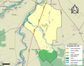
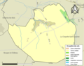
 36058-Concremiers-Sols.png 3,270 × 2,598; 1.88 MB
-
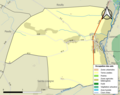
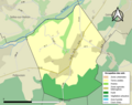
 36059-Condé-Sols.png 3,270 × 2,598; 1.68 MB
-
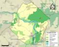
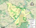
 36065-Diou-Sols.png 3,270 × 2,598; 1.03 MB
-
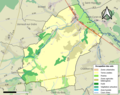
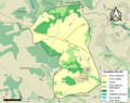
 36068-Dun-le-Poëlier-Sols.png 3,270 × 2,598; 1.73 MB
-
 36074-Fléré-la-Rivière-Sols.png 3,270 × 2,598; 2.05 MB
-
 36075-Fontenay-Sols.png 3,270 × 2,598; 977 KB
-
 36080-Frédille-Sols.png 3,270 × 2,598; 1.1 MB
-
 36082-Gehée-Sols.png 3,270 × 2,598; 2.29 MB
-
 36083-Giroux-Sols.png 3,270 × 2,598; 1.25 MB
-
 36088-Issoudun-Sols.png 3,270 × 2,598; 2.47 MB
-
 36089-Jeu-les-Bois-Sols.png 3,270 × 2,598; 1.67 MB
-
 36090-Jeu-Maloches-Sols.png 3,270 × 2,598; 1.6 MB
-
 36091-Lacs-Sols.png 3,270 × 2,598; 2.37 MB
-
 36092-Langé-Sols.png 3,270 × 2,598; 1.92 MB
-
 36093-Levroux-Sols.png 3,270 × 2,598; 2.46 MB
-
 36097-Liniez-Sols.png 3,270 × 2,598; 1,019 KB
-
 36098-Lizeray-Sols.png 3,270 × 2,598; 1.31 MB
-
 36100-Lourouer-Saint-Laurent-Sols.png 3,270 × 2,598; 1.55 MB
-
 36102-Luçay-le-Libre-Sols.png 3,270 × 2,598; 972 KB
-
 36103-Luçay-le-Mâle-Sols.png 3,270 × 2,598; 2.56 MB
-
 36125-Migny-Sols.png 3,270 × 2,598; 1.48 MB


