Category:Maps of affluents of the Elbe
Jump to navigation
Jump to search
Subcategories
This category has the following 4 subcategories, out of 4 total.
Media in category "Maps of affluents of the Elbe"
The following 18 files are in this category, out of 18 total.
-
Eger Elbe catchment.png 1,600 × 735; 2.26 MB
-
Mueritz-Elde-Wasserstraße.png 766 × 357; 106 KB
-
Glien, Muhrgraben, Ruppiner Kan.png 1,324 × 1,656; 689 KB
-
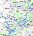
Havelkanal & Sacrow-Paretzer Kanal.png 1,400 × 1,523; 918 KB
-
Havelkanal Karte der Berliner Wasserstrassen.png 1,498 × 1,672; 360 KB
-
Havelkanal.gif 1,296 × 864; 46 KB
-
HavelRhin.gif 1,394 × 1,394; 126 KB
-
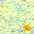
Karte Elde.png 2,221 × 1,221; 2.76 MB
-
Loecknitz.png 404 × 245; 41 KB
-
Mapaohre.jpg 533 × 288; 43 KB
-
Potsdam Spandau Bahn Wasser.png 1,400 × 1,523; 919 KB
-
River Havel.png 800 × 600; 895 KB
-
Karte geplanter Saalekanal.jpg 650 × 440; 155 KB
-
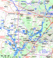
Sacrow-Paretzer Kanal + Potsdamer Havelbogen.jpg 1,400 × 1,400; 2.34 MB
-
Sacrow-Paretzer Kanal + Potsdamer Havelbogen.png 1,401 × 1,400; 906 KB
-
Schwarze Elster Fluss Version 9.gif 1,011 × 741; 300 KB
-
Schwarze Elster Flusssystem 1.gif 646 × 537; 159 KB
-
Vltava River (CZE) - location and watershed.svg 5,342 × 3,123; 149 KB


