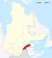
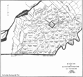
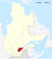
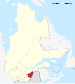
Category:Maps of administrative regions of Quebec
Jump to navigation
Jump to search
Subcategories
This category has only the following subcategory.
Media in category "Maps of administrative regions of Quebec"
The following 112 files are in this category, out of 112 total.
-
Abitibi-Témiscamingue.png 920 × 1,160; 35 KB
-
LocationAbitibi-Témiscamingue.png 2,000 × 2,437; 1.31 MB
-
Abitibi-Témiscamingue in Quebec.svg 512 × 570; 266 KB
-
Assistance sociale quebec fevrier 2015.svg 1,630 × 2,000; 399 KB
-
LocationBas-Saint-Laurent.png 454 × 537; 32 KB
-
LocationBas-Saint-Laurent2.png 2,000 × 2,437; 1.31 MB
-
Bas-Saint-Laurent (Quebec) map.svg 1,630 × 2,000; 304 KB
-
Bas-Saint-Laurent in Quebec.svg 512 × 570; 266 KB
-
Bas-saint-laurent-topo.png 400 × 506; 443 KB
-
Bas-Saint-Laurent.png 436 × 520; 59 KB
-
Bas-saint-laurent.png 920 × 1,160; 35 KB
-
Bas-saint-laurent.PNG 418 × 480; 15 KB
-
Bvlassom.svg 765 × 990; 2.15 MB
-
Canada Côte-Nord Region Quebec.png 1,120 × 985; 393 KB
-
Cantons de l'est 1792-2010-12-03.png 711 × 510; 78 KB
-
Cantons de l'est 1792.GIF 711 × 656; 45 KB
-
Cantons de l'est.jpg 610 × 431; 240 KB
-
Capitale-Nationale in Quebec.svg 512 × 570; 266 KB
-
Capitale-Nationale topo.png 363 × 448; 299 KB
-
Capitale-Nationale.png 920 × 1,160; 34 KB
-
Carte Abitibi-Témiscamingue.png 800 × 885; 995 KB
-
Carte de Lanaudière.png 301 × 366; 195 KB
-
Carte des régions du Québec 1923.jpg 525 × 541; 60 KB
-
Carte du Québec-Blank.png 2,048 × 2,513; 76 KB
-
Carte Mauricie.png 475 × 651; 542 KB
-
Carte Outaouais.png 800 × 960; 999 KB
-
Centre-du-Quebec (Quebec) map.svg 1,630 × 2,000; 304 KB
-
Centre-du-Québec in Quebec.svg 512 × 570; 264 KB
-
Centre-du-Québec topo.png 274 × 207; 104 KB
-
Centre-du-Québec.png 920 × 1,160; 34 KB
-
LocationChaudière-Appalaches.png 2,000 × 2,437; 1.31 MB
-
Chaudière-Appalaches topo.png 400 × 505; 350 KB
-
Chaudière-Appalaches.png 920 × 1,160; 35 KB
-
Chaudières-Appalaches in Quebec.svg 512 × 570; 265 KB
-
Côte-du-Sud.PNG 418 × 480; 15 KB
-
Côte-Nord in Quebec.svg 512 × 570; 289 KB
-
Côte-Nord topo.png 500 × 583; 543 KB
-
Côte-Nord.jpg 800 × 933; 477 KB
-
Côte-Nord.png 920 × 1,160; 36 KB
-
Estrie (Quebec) map.svg 1,630 × 2,000; 304 KB
-
Estrie in Quebec.svg 512 × 570; 266 KB
-
Estrie-topo.png 600 × 619; 508 KB
-
Estrie.png 920 × 1,160; 34 KB
-
Gaspesie-Iles-de-la-Madeleine (Quebec) map.svg 1,630 × 2,000; 304 KB
-
Gaspesie-iles.PNG 920 × 1,160; 34 KB
-
Gaspésie-Iles-de-la-Madeleine in Quebec.svg 512 × 570; 269 KB
-
Gaspésie–Îles-de-la-Madeleine.png 622 × 707; 499 KB
-
Lanaudiere (Quebec) map.svg 1,630 × 2,000; 304 KB
-
Lanaudiere.PNG 920 × 1,160; 35 KB
-
Lanaudière in Quebec.svg 512 × 570; 267 KB
-
Laurentides (Quebec) map.svg 1,630 × 2,000; 304 KB
-
Laurentides in Quebec.svg 512 × 570; 267 KB
-
Laurentides.png 800 × 990; 1,023 KB
-
Laval.png 920 × 1,160; 39 KB
-
Les Laurentides.png 920 × 1,160; 35 KB
-
Les nations autochtones et le Québec.jpg 2,406 × 3,324; 1.46 MB
-
Localisation Québec 09 Côte-Nord.png 419 × 483; 17 KB
-
LocationCapitale-Nationale.png 2,000 × 2,437; 1.31 MB
-
LocationCentre-du-Québec.png 2,000 × 2,437; 1.31 MB
-
LocationCôte-Nord.png 2,000 × 2,437; 1.31 MB
-
LocationEstrie.png 2,000 × 2,437; 1.31 MB
-
LocationGaspésie-Îles-de-la-Madeleine.png 2,000 × 2,437; 1.32 MB
-
LocationLanaudière.png 2,000 × 2,437; 1.31 MB
-
LocationLaurentides.png 2,000 × 2,437; 1.31 MB
-
LocationMauricie.png 2,000 × 2,437; 1.31 MB
-
LocationNord-du-Québec.png 2,000 × 2,437; 1.29 MB
-
LocationOutaouais.png 2,000 × 2,437; 1.31 MB
-
LocationSaguenay-Lac-Saint-Jean.png 2,000 × 2,437; 1.31 MB
-
Mauricie (Quebec) map.svg 1,630 × 2,000; 304 KB
-
Mauricie in Quebec.svg 512 × 570; 266 KB
-
Mauricie regions map.png 1,524 × 1,268; 639 KB
-
Mauricie regions map.svg 750 × 625; 3.41 MB
-
Mauricie.png 920 × 1,160; 35 KB
-
Monteregie (Quebec) map.svg 1,630 × 2,000; 304 KB
-
Montréal.png 920 × 1,160; 39 KB
-
LocationMontérégie.png 2,000 × 2,437; 1.31 MB
-
Montérégie in Quebec.svg 512 × 570; 268 KB
-
Montérégie-topo.png 649 × 600; 518 KB
-
Montérégie.png 920 × 1,160; 34 KB
-
Montérégie.PNG 351 × 409; 12 KB
-
Nord-du-Quebec (Quebec) map.svg 1,630 × 2,000; 304 KB
-
Nord-du-Québec in Quebec.svg 512 × 570; 300 KB
-
Nord-du-Québec topo.png 600 × 781; 849 KB
-
Nord-du-Québec.PNG 920 × 1,160; 36 KB
-
NordQuébec.png 444 × 520; 64 KB
-
Nunavik-Québec.PNG 280 × 230; 14 KB
-
Outaouais (Quebec) map.svg 1,630 × 2,000; 304 KB
-
Outaouais in Quebec.svg 512 × 570; 268 KB
-
Outaouais.png 920 × 1,160; 35 KB
-
Qc Basse-Cote-Nord.png 920 × 1,160; 35 KB
-
Quebec Regions sud.PNG 910 × 536; 25 KB
-
Quelam.PNG 420 × 482; 15 KB
-
Quelav.PNG 418 × 480; 18 KB
-
Quelet.PNG 421 × 483; 15 KB
-
Quelev.PNG 424 × 483; 15 KB
-
Quelgr.PNG 421 × 483; 15 KB
-
Quelhs.PNG 421 × 483; 15 KB
-
Quelis.PNG 421 × 483; 15 KB
-
Quelnb.PNG 420 × 482; 15 KB
-
Quelot.PNG 421 × 483; 15 KB
-
Quemng.PNG 421 × 483; 15 KB
-
Quemont.png 418 × 480; 17 KB
-
Québec-map.png 418 × 480; 16 KB
-
Regions administratives du Quebec.png 458 × 534; 45 KB
-
Régions administratives du Québec.svg 1,184 × 1,318; 460 KB
-
Saguenay-Lac-Saint-Jean (Quebec) map.svg 1,630 × 2,000; 304 KB
-
Saguenay-Lac-Saint-Jean in Quebec.svg 512 × 570; 268 KB
-
Saguenay-lac-saint-jean.PNG 920 × 1,160; 35 KB
-
Saguenay-lac-saint-jean.png 419 × 483; 19 KB
-
Saguenay–Lac-Saint-Jean.png 708 × 924; 1.15 MB
-
Townships.png 418 × 480; 12 KB
-
Verwaltungsgliederung Quebecs.png 419 × 483; 14 KB


