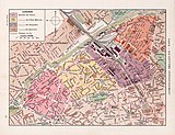
Category:Maps of administrative quartiers of Paris
Jump to navigation
Jump to search
Subcategories
This category has the following 6 subcategories, out of 6 total.
Media in category "Maps of administrative quartiers of Paris"
The following 8 files are in this category, out of 8 total.
-
Albert Demersseman, Paris en 80 quartiers, 1933 - Gallica.jpg 16,542 × 13,383; 48.32 MB
-
André Lesot, Plan de Paris par arrondissements et quartiers, c. 1972 - BHVP.jpg 3,302 × 2,738; 1.23 MB
-
Institut géographique national, Limites administratives de Paris, 1960 - BHVP.jpg 6,188 × 4,392; 4.11 MB
-
Les quartiers de paris.png 1,374 × 1,012; 272 KB
-
Parisko auzoak.png 800 × 589; 343 KB
-
Plan cadastral de la ville de Paris (1898).jpg 15,178 × 12,075; 79.81 MB
-
Quartiers administratifs de Paris.svg 1,165 × 656; 60 KB


