Category:Maps of administrative divisions of India by User:Milenioscuro
Jump to navigation
Jump to search
Subcategories
This category has only the following subcategory.
Media in category "Maps of administrative divisions of India by User:Milenioscuro"
The following 16 files are in this category, out of 16 total.
-
 India Andhra Pradesh location map (current).svg 1,027 × 849; 358 KB
-
 India Assam location map.svg 1,414 × 978; 580 KB
-
 India Chhattisgarh location map.svg 1,152 × 1,443; 473 KB
-
 India Goa location map.svg 794 × 960; 219 KB
-
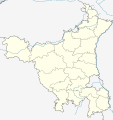 India Haryana location map.svg 845 × 899; 253 KB
-
 India Jharkhand location map.svg 1,162 × 865; 611 KB
-
 India Manipur location map.svg 862 × 903; 212 KB
-
 India Meghalaya location map.svg 1,152 × 497; 230 KB
-
 India Nagaland location map.svg 889 × 821; 192 KB
-
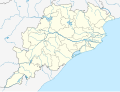 India Odisha location map.svg 1,128 × 860; 402 KB
-
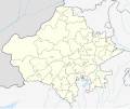 India Rajasthan location map.svg 1,093 × 916; 511 KB
-
 India Sikkim location map.svg 530 × 610; 307 KB
-
 India Telangana location map.svg 851 × 852; 367 KB
-
 India Uttarakhand location map.svg 957 × 795; 311 KB
-
 Kashmir location map.svg 1,722 × 1,301; 217 KB
-
 Kashmir relief location map.svg 1,720 × 1,300; 2.94 MB
.svg)


