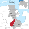
Category:Maps of Zetel
Jump to navigation
Jump to search
Landkreis Friesland  Bockhorn · Jever · Sande · Schortens · Varel · Wangerland · Wangerooge · Zetel ·
| NO WIKIDATA ID FOUND! Search for Maps of Zetel on Wikidata | |
| Upload media |
Media in category "Maps of Zetel"
The following 7 files are in this category, out of 7 total.
-
DB 1532 railway map.png 1,485 × 1,060; 1,021 KB
-
Forts Wilhelmshaven Karte.png 2,553 × 1,868; 2.69 MB
-
Forts Wilhelmshaven OSM.png 2,553 × 1,868; 2.69 MB
-
J011 2021-11-21 Zetel-Ost Eisenbahn.JPG 4,032 × 3,024; 6.48 MB
-
Lange diercke sachsen deutsche landschaften wattenkueste.jpg 1,235 × 2,057; 1.14 MB
-
Map elbe mouth 1910.jpg 1,500 × 927; 787 KB
-
Zetel in FRI.svg 1,425 × 1,425; 533 KB


