Category:Maps of Zeist
Jump to navigation
Jump to search
Wikimedia category | |||||
| Upload media | |||||
| Instance of | |||||
|---|---|---|---|---|---|
| Category combines topics | |||||
| Zeist | |||||
municipality in the Dutch province of Utrecht | |||||
| Spoken text audio | |||||
| Instance of |
| ||||
| Location | Utrecht, Netherlands | ||||
| Capital | |||||
| Head of government |
| ||||
| Population |
| ||||
| Area |
| ||||
| Elevation above sea level |
| ||||
| official website | |||||
 | |||||
Subcategories
This category has the following 2 subcategories, out of 2 total.
Media in category "Maps of Zeist"
The following 27 files are in this category, out of 27 total.
-
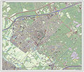
2013-Zeist.jpg 2,070 × 2,400; 3.04 MB
-
BAG woonplaatsen - Gemeente Zeist.png 2,419 × 2,419; 918 KB
-
Gem-Zeist-2014Q1.jpg 3,799 × 4,614; 11.71 MB
-
Gem-Zeist-OpenTopo.jpg 4,418 × 5,605; 5.02 MB
-
Gemeentehuis Zeist location.jpg 1,251 × 894; 126 KB
-
Kasteel met omgeving, reproductie vogelvlucht tekening - Zeist - 20377756 - RCE.jpg 2,556 × 1,798; 1.44 MB
-
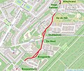
Kerckeboschlaan 2020 OSM.jpg 991 × 839; 272 KB
-
LocatieZeist.png 270 × 130; 9 KB
-
Map - NL - Zeist (2009).svg 625 × 575; 2.43 MB
-
Map NL - Zeist - Austerlitz.png 800 × 600; 10 KB
-
Map NL - Zeist - Den Dolder.png 800 × 600; 10 KB
-
NL - locator map municipality code GM0355 (2016).png 2,125 × 1,417; 608 KB
-
OpenStreetMap Kerckebosch.jpg 1,052 × 794; 406 KB
-
Reproductie naar tekening - Zeist - 20221439 - RCE.jpg 2,256 × 1,769; 908 KB
-
Reproductie naar tekening - Zeist - 20221447 - RCE.jpg 840 × 1,200; 447 KB
-
Reproductie naar tekening - Zeist - 20221449 - RCE.jpg 2,778 × 2,002; 1.38 MB
-
Reproductie naar tekening - Zeist - 20221450 - RCE.jpg 2,304 × 1,768; 924 KB
-
Rijksbeschermd stads- of dorpsgezicht - Zeist - Wilhelminapark.png 2,016 × 2,267; 153 KB
-
Ring Utrecht.gif 580 × 400; 49 KB
-
Zeist-Buurten-en-Wijken.Svg 1,200 × 800; 131 KB
-
Zeist-Kerckebosch Hoog Kanje OSM.jpg 1,061 × 821; 276 KB
-
Zeist-plaats-OpenTopo.jpg 2,079 × 1,831; 2.33 MB
-
Zeist-stad-2014Q1.jpg 2,103 × 1,831; 2.12 MB
-
Zeist-topografie.jpg 1,565 × 1,734; 1.86 MB
-
Zeist.png 1,396 × 1,725; 308 KB


