Category:Maps of Zagreb districts
Jump to navigation
Jump to search
Media in category "Maps of Zagreb districts"
The following 40 files are in this category, out of 40 total.
-
District Brezovica (Zagreb).PNG 577 × 632; 56 KB
-
District Donja Dubrava (Zagreb).PNG 577 × 632; 56 KB
-
District Donji grad (Zagreb).PNG 577 × 632; 56 KB
-
District Gornja Dubrava (Zagreb).PNG 577 × 632; 56 KB
-
District Gornji grad - Medveščak (Zagreb).PNG 577 × 632; 56 KB
-
District Maksimir (Zagreb).png 577 × 632; 64 KB
-
District Novi Zagreb - Istok (Zagreb).PNG 577 × 632; 55 KB
-
District Novi Zagreb - Zapad (Zagreb).PNG 577 × 632; 56 KB
-
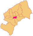
District of Zagreb.svg 721 × 790; 45 KB
-
District Peščenica - Žitnjak (Zagreb).PNG 577 × 632; 55 KB
-
District Podsljeme (Zagreb).PNG 577 × 632; 56 KB
-
District Podsused - Vrapče (Zagreb).PNG 577 × 632; 55 KB
-
District Sesvete (Zagreb).PNG 577 × 632; 56 KB
-
District Stenjevec (Zagreb).PNG 577 × 632; 55 KB
-
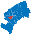
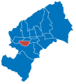
District Trešnjevka Jug (Zagreb).PNG 577 × 632; 55 KB
-
District Trešnjevka Sjever (Zagreb).PNG 577 × 632; 55 KB
-
District Trnje (Zagreb).PNG 577 × 632; 56 KB
-
District Črnomerec (Zagreb).PNG 577 × 632; 56 KB
-
Districts of Zagreb (map with numbers).svg 1,366 × 1,498; 213 KB
-
Districts of Zagreb (map).svg 1,366 × 1,498; 63 KB
-
Map of Brezovica District (Zagreb).svg 512 × 562; 69 KB
-
Map of Donja Dubrava District (Zagreb).svg 1,366 × 1,498; 64 KB
-
Map of Donji Grad District (Zagreb).svg 1,366 × 1,498; 64 KB
-
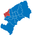
Map of Gornja Dubrava District (Zagreb).svg 1,366 × 1,498; 64 KB
-
Map of Gornji Grad-Medveščak District (Zagreb).svg 1,093 × 1,198; 64 KB
-
Map of Maksimir District (Zagreb).svg 1,366 × 1,498; 64 KB
-
Map of Novi Zagreb-Istok District (Zagreb).svg 1,366 × 1,498; 64 KB
-
Map of Novi Zagreb-Zapad District (Zagreb).svg 1,366 × 1,498; 64 KB
-
Map of Peščenica-Žitnjak District (Zagreb).svg 1,093 × 1,198; 64 KB
-
Map of Podsljeme District (Zagreb).svg 1,366 × 1,498; 64 KB
-
Map of Podsused-Vrapče District (Zagreb).svg 1,366 × 1,498; 64 KB
-
Map of Sesvete District (Zagreb).svg 1,366 × 1,498; 65 KB
-
Map of Stenjevec District (Zagreb).svg 1,366 × 1,498; 64 KB
-
Map of Trešnjevka (Zagreb).png 821 × 900; 71 KB
-
Map of Trešnjevka-Jug District (Zagreb).svg 1,093 × 1,198; 64 KB
-
Map of Trešnjevka-Sjever District (Zagreb).svg 1,093 × 1,198; 64 KB
-
Map of Trnje District (Zagreb).svg 1,366 × 1,498; 64 KB
-
Map of Črnomerec District (Zagreb).svg 1,093 × 1,198; 64 KB
-
Radnička fronta u Zagrebu.png 400 × 439; 38 KB
-
Zagreb's city districts.png 400 × 438; 39 KB


