Category:Maps of Zadar
Jump to navigation
Jump to search
Wikimedia category | |||||
| Upload media | |||||
| Instance of | |||||
|---|---|---|---|---|---|
| Category combines topics | |||||
| Zadar | |||||
city and settlement in Zadar County, Croatia | |||||
| Pronunciation audio | |||||
| Instance of |
| ||||
| Patron saint | |||||
| Location | |||||
| Head of government |
| ||||
| Inception |
| ||||
| Population |
| ||||
| Area |
| ||||
| Elevation above sea level |
| ||||
| Different from | |||||
| official website | |||||
 | |||||
Subcategories
This category has the following 2 subcategories, out of 2 total.
O
- Old maps of Zadar (1 P, 6 F)
Media in category "Maps of Zadar"
The following 20 files are in this category, out of 20 total.
-
1579 map of the Croatian Coastline, centered on Zadar by Johannes Matalius Metellus.jpg 1,559 × 1,200; 515 KB
-
1800 Zara map Turkey in Europe and Hungary by Mathew Carey BPL 12328 detail 3.png 1,063 × 746; 1.63 MB
-
Admiralty Chart No 2711 Zadar to Sibenik, Published 1964.jpg 16,392 × 11,284; 36.32 MB
-
Admiralty Chart No 2774, Published 1877 (Port Zara).jpg 2,245 × 2,097; 696 KB
-
Admiralty Chart No 2775 Port of Zadar and Aproaches, Published 1959.jpg 13,474 × 9,572; 24.12 MB
-
Admiralty Chart No 515 Mali Losinj and Prizna to Zadar, Published 1963.jpg 16,366 × 11,244; 20.16 MB
-
BV043564102.tif 6,477 × 4,476; 76.93 MB
-
Central Croatian Adriatic.png 773 × 736; 183 KB
-
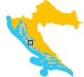
Croatia location map Zadar.svg 215 × 157; 400 KB
-
Tuto el Cotado di Zara e Sebenicho.jpg 1,680 × 937; 599 KB
-
Umgebung von Zadar, 1869.tif 982 × 737; 2.75 MB
-
Zadar city center map.jpg 2,281 × 3,217; 2.14 MB
-
Zadar in croatia.jpg 120 × 109; 10 KB
-
Zadar map-Croatia.PNG 418 × 266; 4 KB
-
Zadar, Dalmatia (1600).jpg 800 × 600; 157 KB
-
Zadarska nadbiskupija - dekanati i župe - karta.png 3,023 × 2,492; 798 KB
-
Zara-Zadar-1920-1947 (without border).png 2,363 × 2,877; 2.01 MB
-
Zara-Zadar-1920-1947 cropped.png 2,393 × 3,157; 1.34 MB
-
Zara-Zadar-1920-1947.png 2,449 × 4,017; 1.83 MB


