Category:Maps of World War II in Asia
Jump to navigation
Jump to search
Subcategories
This category has the following 2 subcategories, out of 2 total.
M
Media in category "Maps of World War II in Asia"
The following 51 files are in this category, out of 51 total.
-
1944 Chapin Map of Burma during World War II for TIME Magazine.jpg 2,141 × 6,000; 3.98 MB
-
1945 Chapin map of Japan, China and Korea during World War II for TIME Magazine.jpg 6,190 × 7,000; 15.56 MB
-
WWII - Pacific, January, 1945.jpg 1,024 × 748; 247 KB
-
AAF Cloth Chart - Asiatic Series, No. 34, Southeast China.jpg 1,936 × 2,563; 1.99 MB
-
Chengtu Area Airfields.jpg 1,404 × 1,056; 219 KB
-
Corregidor Island Map.jpg 2,000 × 1,265; 356 KB
-
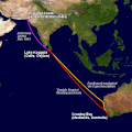
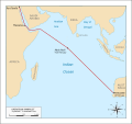
Double Sunrise Route.gif 540 × 540; 53 KB
-
Empîrtanîya Japonan-2.jpg 711 × 996; 308 KB
-
Hump routes of the XX Bomber Command.jpg 1,809 × 1,371; 516 KB
-
In the net.jpg 643 × 687; 204 KB
-
Japanese "Tunghua Redoubt" defense plan.png 524 × 816; 234 KB
-
Japanese Fifth Army operations, Manchuria 1945.png 1,056 × 789; 330 KB
-
Japanese First Area Army's defense plan 1945.png 624 × 923; 217 KB
-
Japanese Forty Fourth Army Operations 1945.png 527 × 816; 280 KB
-
Japanese Fourth Army, Manchuria1945.png 1,056 × 672; 292 KB
-
Japanese Thirtieth Army Operations 1945.png 520 × 816; 269 KB
-
ManchuriaFrontlineAugust15.png 684 × 978; 274 KB
-
MapofBinjiang.svg 400 × 225; 229 KB
-
NavWarMap No. 2 - The South China Sea Area.jpg 35,202 × 23,768; 283.44 MB
-
NavWarMap No. 4 - The North Pacific Area.jpg 36,574 × 25,499; 330.2 MB
-
NavWarMap No. 5 - Southwest Pacific.jpg 9,000 × 6,105; 9.29 MB
-
Navy War Map No. 2 - The South China Sea Area.jpg 9,000 × 6,014; 13.5 MB
-
Newsmap - July 9, 1945.jpg 1,968 × 1,473; 1.45 MB
-
Newsmap - May 7, 1945.jpg 2,579 × 1,920; 1.54 MB
-
Op Banquet.jpg 1,020 × 730; 126 KB
-
Operation Pamphlet 24 Jan - 27 Feb 1943.svg 1,075 × 1,011; 61 KB
-
Operation PamphletFRENCH.png 2,265 × 2,148; 255 KB
-
Operation-Causeway-Phase-1.jpg 2,873 × 3,078; 339 KB
-
Pacific & Adjacent areas 1942 CMH Pub 72-22.jpg 1,000 × 736; 228 KB
-
Seaport trinity russia map.jpg 712 × 873; 93 KB
-
Second world war asia 1937-1942 map en6.png 1,298 × 998; 250 KB
-
Second world war asia 1937-1942 map-es.svg 1,387 × 1,067; 876 KB
-
Second world war asia 1937-1942 map-fr.svg 1,300 × 1,000; 1.61 MB
-
Second world war asia sw pacific map de-1.png 667 × 502; 77 KB
-
Segonda Guèrra Mondiala - Teatre asiatic - 1937-1942.png 1,964 × 1,458; 962 KB
-
Segonda Guèrra Mondiala - Teatre chinés.png 503 × 429; 140 KB
-
Situation at Surrender - NARA - 50925960.jpg 2,009 × 2,757; 1.76 MB
-
Soviet Amphibious Landing Chongjin 1945.png 1,056 × 672; 352 KB
-
Territorial victors against axis powers (Asia and Pacific).png 7,680 × 4,320; 3.66 MB
-
The first proposals for the division of Japan - WW2.png 4,470 × 3,510; 724 KB
-
The Hump and Burma Road.png 1,120 × 796; 343 KB
-
Theaters of Chinese National Revolutionary Army.png 2,480 × 3,508; 672 KB
-
USA-CBI-Time-1.jpg 1,800 × 1,978; 342 KB
-
Villa verde trail Philippines.jpg 1,800 × 1,300; 378 KB
-
Ww2-pacific globe map.jpg 640 × 639; 87 KB
-
WWII RAAF map of the Manila area.jpg 4,032 × 1,960; 2.99 MB
-
台儿庄会战.png 704 × 595; 180 KB


