Category:Maps of Woltersdorf (bei Berlin)
Jump to navigation
Jump to search
Wikimedia category | |||||
| Upload media | |||||
| Instance of | |||||
|---|---|---|---|---|---|
| Category combines topics | |||||
| Woltersdorf | |||||
municipality in Oder-Spree district, Brandenburg state, Germany | |||||
| Instance of |
| ||||
| Location | Oder-Spree District, Brandenburg, Germany | ||||
| Street address |
| ||||
| Population |
| ||||
| Area |
| ||||
| Elevation above sea level |
| ||||
| Different from | |||||
| official website | |||||
 | |||||
Media in category "Maps of Woltersdorf (bei Berlin)"
The following 15 files are in this category, out of 15 total.
-
Die erste Schleuse.png 368 × 735; 54 KB
-
Die Woltersdorfer Gutsheide bis 1859.png 4,728 × 3,626; 671 KB
-
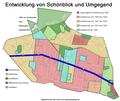
Entwicklung von Schönblick und Umgegend.png 829 × 700; 336 KB
-
Gebietsentwicklung von Woltersdorf.png 2,037 × 1,638; 2 MB
-
Gebietsveränderungen von Woltersdorf.png 504 × 384; 31 KB
-
Gebietsveränderungen.png 515 × 372; 33 KB
-
Gelände von Knoch's Kurhaus in Woltersdorf.png 977 × 722; 110 KB
-
Gemeinde Woltersdorf (Ein- und Ausgemeindungen).png 2,037 × 1,494; 1.75 MB
-
Heutige Aufteilung der Woltersdorfer Heide.png 1,304 × 991; 675 KB
-
Karte Straßenbahn Woltersdorf.png 2,539 × 1,358; 581 KB
-
Rittergut Woltersdorf - Besitzstand im Jahr 1859.png 1,375 × 1,116; 1.32 MB
-
Schönblick um 1910.png 1,966 × 1,228; 266 KB
-
Variantes tram Woltersdorf.svg 1,857 × 709; 1.96 MB
-
Woltersdorf in LOS.png 299 × 299; 8 KB
-
Woltersdorf-Stolp um 1880.png 1,111 × 1,111; 111 KB


