Category:Maps of Winterthur
Jump to navigation
Jump to search
Wikimedia category | |||||
| Upload media | |||||
| Instance of | |||||
|---|---|---|---|---|---|
| Category combines topics | |||||
| Winterthur | |||||
city in the canton of Zürich, Switzerland | |||||
| Instance of |
| ||||
| Part of |
| ||||
| Location | Winterthur District, Canton of Zürich, Switzerland | ||||
| Located in or next to body of water | |||||
| Visitor center | |||||
| Legislative body |
| ||||
| Official language | |||||
| Head of government |
| ||||
| Heritage designation | |||||
| Highest point |
| ||||
| Population |
| ||||
| Area |
| ||||
| Elevation above sea level |
| ||||
| Budget |
| ||||
| official website | |||||
 | |||||
Subcategories
This category has the following 2 subcategories, out of 2 total.
M
- Maps of Winterthur Quarters (88 F)
O
Media in category "Maps of Winterthur"
The following 19 files are in this category, out of 19 total.
-
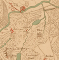
Dättnau Gygerkarte.jpg 287 × 355; 69 KB
-
Gygerkarte Burg Buch.png 1,250 × 1,079; 2.17 MB
-
Gygerkarte Burg Dättnau.png 943 × 963; 1.49 MB
-
Gygerkarte Burg Gamser.png 927 × 693; 1.01 MB
-
Gygerkarte Burg Langenberg.png 1,234 × 866; 1.67 MB
-
Gygerkarte Eschenberg.png 1,164 × 921; 1.62 MB
-
Gygerkarte Seen 1664.JPG 780 × 554; 148 KB
-
Gygerkarte Seen Oberseen Stocken 1664.JPG 381 × 392; 52 KB
-
Karte Friedhof Rosenberg.svg 821 × 1,425; 253 KB
-
Töss 1831.jpg 1,728 × 1,152; 783 KB
-
Wildkarte Hegi.jpg 1,952 × 1,464; 1.15 MB
-
Wildkarte Oberwinterthur (mit Grenzverlauf).jpg 2,713 × 3,618; 4.11 MB
-
Wildkarte Oberwinterthur.jpg 2,713 × 3,618; 4.01 MB
-
Wildkarte, Blatt 11 (Winterthur).jpg 7,854 × 5,642; 15.75 MB
-
Wildkarte, Blatt 15 (Kyburg).jpg 7,854 × 5,642; 15.87 MB
-
Winterthur Gygerkarte 1664.png 311 × 395; 349 KB
-
Winterthur Siegfriedkarte 1881.jpg 1,640 × 1,230; 672 KB
-
Winterthur Switzerland street map.svg 1,328 × 1,213; 4.47 MB
-
Winterthur1292.jpg 454 × 472; 87 KB


