Category:Maps of Winterswijk
Jump to navigation
Jump to search
Wikimedia category | |||||
| Upload media | |||||
| Instance of | |||||
|---|---|---|---|---|---|
| Category combines topics | |||||
| Winterswijk | |||||
municipality in Gelderland, the Netherlands | |||||
| Instance of |
| ||||
| Location | Gelderland, Netherlands | ||||
| Capital | |||||
| Head of government |
| ||||
| Population |
| ||||
| Area |
| ||||
| Elevation above sea level |
| ||||
| official website | |||||
 | |||||
Subcategories
This category has only the following subcategory.
Media in category "Maps of Winterswijk"
The following 17 files are in this category, out of 17 total.
-
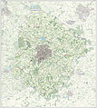
2013-Winterswijk.jpg 2,674 × 2,954; 3.99 MB
-
BAG woonplaatsen - Gemeente Winterswijk.png 2,419 × 2,419; 787 KB
-
Gem-Winterswijk-2014Q1.jpg 5,221 × 5,827; 9.91 MB
-
Gem-Winterswijk-OpenTopo.jpg 6,168 × 6,988; 6.58 MB
-
Karte gelderland winterswijk.jpg 300 × 208; 28 KB
-
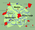
Landschap winterswijk.png 700 × 600; 66 KB
-
Landschap winterswijk.svg 637 × 540; 306 KB
-
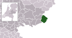
LocatieWinterswijk.png 280 × 140; 9 KB
-
Map - NL - Winterswijk (2009).svg 625 × 575; 683 KB
-
NL - locator map municipality code GM0294 (2016).png 2,125 × 1,417; 354 KB
-
Topografische kaart Winterswijk 1911.jpg 1,490 × 1,020; 1.09 MB
-
Verzamelplan Winterswijk 1828.jpg 4,000 × 2,645; 1.24 MB
-
Winterswijk, Gemeenteatlas van Nederland.jpg 1,657 × 2,184; 4.59 MB
-
Winterswijk-dorp-2014Q1.jpg 1,622 × 1,595; 1.29 MB
-
Winterswijk-plaats-OpenTopo.jpg 1,622 × 1,595; 1.37 MB
-
Winterswijk-topografie.jpg 1,209 × 1,467; 1.17 MB


