Category:Maps of Winnipeg
Jump to navigation
Jump to search
Wikimedia category | |||||
| Upload media | |||||
| Instance of | |||||
|---|---|---|---|---|---|
| Category combines topics | |||||
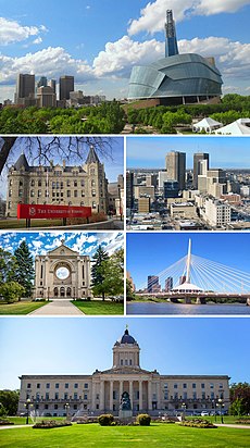
| Winnipeg | |||||
capital and largest city of the province of Manitoba, Canada | |||||
| Pronunciation audio | |||||
| Instance of |
| ||||
| Part of | |||||
| Named after | |||||
| Location | Winnipeg Metropolitan Region, Manitoba, Canada | ||||
| Located in or next to body of water | |||||
| Legislative body |
| ||||
| Head of government |
| ||||
| Inception |
| ||||
| Population |
| ||||
| Area |
| ||||
| Elevation above sea level |
| ||||
| Different from | |||||
| official website | |||||
 | |||||
Subcategories
This category has the following 3 subcategories, out of 3 total.
O
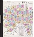
- Old maps of Winnipeg (9 F)
T
- Travel maps of Winnipeg (1 F)
Media in category "Maps of Winnipeg"
The following 88 files are in this category, out of 88 total.
-
-A Guide to Winnipeg- (1924) (3258706886).jpg 9,337 × 4,884; 13.68 MB
-
-St. John's Cemetery Plan- (1931) (3193912015).jpg 9,656 × 5,601; 11.5 MB
-
-Winnipeg Forts- (1887) (3750295718).jpg 2,806 × 4,662; 2.56 MB
-
1919 Winnipeg General Strike a Driving and Walking Tour (1985) (2110422945).jpg 3,043 × 3,223; 5.67 MB
-
Bird's Eye View of Winnipeg (1881).jpg 9,677 × 6,302; 8.38 MB
-
Canadian Cities - DPLA - a9cadde2681da78b7b0f329c08ed6471.jpg 15,604 × 11,513; 20.74 MB
-
Centennial, Winnipeg location on a map.png 800 × 864; 289 KB
-
Central Park, Winnipeg location on a map.png 800 × 864; 291 KB
-
Chataway’s Map of Winnipeg (1919) (2212284333).jpg 7,991 × 9,549; 15.16 MB
-
Crescentwood Winnipeg’s Best Residential District (1911) (3762093332).jpg 5,698 × 4,061; 7.86 MB
-
Crescentwood Winnipeg’s Best Residential District (1917) (3752512531).jpg 9,264 × 5,977; 11.48 MB
-
Crime concentration in Winnipeg.jpg 1,964 × 2,216; 241 KB
-
Greater Winnipeg Application of Zoning Regulations (1947) (3223613956).jpg 4,408 × 5,695; 5.46 MB
-
Greater Winnipeg Areas Available for Potential Residential Use (1948) (3232639678).jpg 5,844 × 3,898; 7.06 MB
-
Greater Winnipeg Business District Present Transit Flow (1946) (3214787417).jpg 6,026 × 4,511; 6.31 MB
-
Greater Winnipeg Central Business District Assessed Value of Land (1948) (3238709727).jpg 9,036 × 4,534; 12.37 MB
-
Greater Winnipeg Central Business District Building Heights (1948) (3234956566).jpg 6,066 × 4,603; 7.73 MB
-
Greater Winnipeg Central Business District Civic and Public Uses (1948) (3234976014).jpg 6,084 × 4,622; 6.9 MB
-
Greater Winnipeg Central Business District Office and Retail Uses (1948) (3234052817).jpg 3,960 × 6,020; 6.68 MB
-
Greater Winnipeg Central Business District Present Transit Routes (1948) (3239446452).jpg 6,360 × 4,682; 7.33 MB
-
Greater Winnipeg Central Business District Proposed Transit Routes (1948) (3238645651).jpg 6,408 × 4,794; 7.55 MB
-
Greater Winnipeg Central Business District Proposed Zoning (1948) (3238690901).jpg 6,400 × 4,745; 9.57 MB
-
Greater Winnipeg Central District Street Parking (1946) (3232106157).jpg 6,496 × 4,771; 8.06 MB
-
Greater Winnipeg Condition of Housing (1948) (3231748303).jpg 5,902 × 4,529; 9.34 MB
-
Greater Winnipeg Crowded Households (1948) (3232580440).jpg 5,908 × 4,528; 8.2 MB
-
Greater Winnipeg Governmental Housing Construction (1948) (3232521182).jpg 5,867 × 3,863; 7.3 MB
-
Greater Winnipeg Major Thorofare Plan (1946) (3232889248).jpg 6,250 × 4,004; 7.22 MB
-
Greater Winnipeg Metropolitan Area Watersheds (1946) (3131084354).jpg 5,754 × 4,496; 5.82 MB
-
Greater Winnipeg Original Area and Municipal Development (1946) (3131023426).jpg 5,774 × 4,373; 4.23 MB
-
Greater Winnipeg Paved Streets and Areas Served by Sewers and Water (1946) (3232864114).jpg 6,252 × 3,990; 6.79 MB
-
Greater Winnipeg Present Business District Transit Routes (1946) (3215623198).jpg 6,058 × 4,508; 6.92 MB
-
Greater Winnipeg Present Capacities Major Thorofares (1946) (3232065389).jpg 6,258 × 4,002; 7.45 MB
-
Greater Winnipeg Present Duplication of Transit Service (1946) (3213341034).jpg 5,936 × 3,908; 5.95 MB
-
Greater Winnipeg Present Grade Crossings and Separations (1946) (3232876924).jpg 6,432 × 4,246; 7.15 MB
-
Greater Winnipeg Present Parks and Recreation Areas (1947) (3222624295).jpg 5,808 × 3,995; 7.05 MB
-
Greater Winnipeg Present Population Distribution (1946) (3130232065).jpg 5,699 × 3,766; 5.51 MB
-
Greater Winnipeg Present Street Widths (1946) (3231995193).jpg 6,408 × 4,283; 7.03 MB
-
Greater Winnipeg Present Transit Lines Areas and Population Served (1946) (3212398413).jpg 6,013 × 3,914; 8.67 MB
-
Greater Winnipeg Present Transit Time Zones (1946) (3213317664).jpg 5,914 × 3,909; 6.3 MB
-
Greater Winnipeg Present Transportation Facilities (1946) (3209393581).jpg 5,948 × 3,903; 7.34 MB
-
Greater Winnipeg Proposed Interurban Bus Routes (1946) (3210352764).jpg 6,106 × 3,983; 7.82 MB
-
Greater Winnipeg Proposed Neighborhood Standards (1947) (3223543062).jpg 6,119 × 4,539; 5.3 MB
-
Greater Winnipeg Proposed Neighborhoods Schools Parks Recreation Areas (1947) (3215806698).jpg 8,028 × 5,374; 18.15 MB
-
Greater Winnipeg Proposed Parkways (1947) (3215865016).jpg 8,055 × 5,274; 12.89 MB
-
Greater Winnipeg Proposed Thorofare Capacities (1946) (3232930036).jpg 6,504 × 4,257; 7.82 MB
-
Greater Winnipeg Proposed Transit System (1946) (3212517331).jpg 5,939 × 3,966; 5.15 MB
-
Greater Winnipeg Tax Forfeited Lands (1946) (3130341037).jpg 5,744 × 3,757; 6.4 MB
-
Greater Winnipeg Tentative Airport Plan (1946) (3209448195).jpg 6,106 × 4,782; 7.68 MB
-
Greater Winnipeg Tentative Railway Plan (1946) (3210274030).jpg 5,968 × 4,012; 7.53 MB
-
Greater Winnipeg Urban Developed Areas and Barriers to Growth (1946) (3131138942).jpg 6,048 × 4,733; 7.65 MB
-
Greater Winnipeg Wage-Earner Households (1948) (3231713007).jpg 5,919 × 4,530; 8.27 MB
-
Linden Woods, Winnipeg location on a map.png 800 × 864; 265 KB
-
Mjhl map 2013.png 290 × 390; 21 KB
-
Old northeast Winnipeg map photo.jpg 1,092 × 842; 390 KB
-
Tourist Map of the City of Winnipeg and Vicinity (1949) (3194230091).jpg 9,792 × 5,403; 13.21 MB
-
West End Map, Winnipeg, Manitoba, Canada.png 1,287 × 1,546; 671 KB
-
West Sheet of Chataway’s Map of Greater Winnipeg (1912) (2201273363).jpg 5,312 × 10,666; 8.37 MB
-
Winnipeg (1915) (2656067342).jpg 4,476 × 3,278; 7.71 MB
-
Winnipeg (40th Parl).png 289 × 263; 5 KB
-
Winnipeg (41st Parl).png 289 × 263; 5 KB
-
Winnipeg -1948- (2802659777).jpg 5,180 × 8,524; 8.67 MB
-
Winnipeg 1915.jpg 1,024 × 750; 804 KB
-
Winnipeg Bird's-Eye View (1884) (2182110970).jpg 12,068 × 8,892; 9.67 MB
-
Winnipeg in 1869 (1879) (2338522025).jpg 3,955 × 2,397; 8.11 MB
-
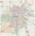
Winnipeg location map.png 446 × 450; 214 KB
-
Winnipeg, the Capital of Manitoba, in the Canadian Dominion (1881) (2301109386).jpg 3,716 × 2,543; 5.24 MB
-
Winnipeg.jpg 1,424 × 1,316; 2.02 MB
-
Winnipegmanitoba.png 302 × 432; 9 KB
-
Zoning-maps-winnipeg-9370554-o.jpg 8,300 × 5,539; 18.91 MB


