Category:Maps of Westland
Jump to navigation
Jump to search
Wikimedia category | |||||
| Upload media | |||||
| Instance of | |||||
|---|---|---|---|---|---|
| Category combines topics | |||||
| Westland | |||||
municipality in the Netherlands | |||||
| Pronunciation audio | |||||
| Instance of |
| ||||
| Location | South Holland, Netherlands | ||||
| Capital | |||||
| Head of government |
| ||||
| Inception |
| ||||
| Population |
| ||||
| Area |
| ||||
| Elevation above sea level |
| ||||
| Replaces |
| ||||
| official website | |||||
 | |||||
Subcategories
This category has the following 8 subcategories, out of 8 total.
M
- Maps of 's-Gravenzande (5 F)
- Maps of De Lier (3 F)
- Maps of Kwintsheul (6 F)
- Maps of Wateringen (11 F)
O
Media in category "Maps of Westland"
The following 29 files are in this category, out of 29 total.
-
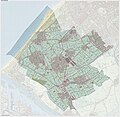
2013-Westland.jpg 2,548 × 2,508; 3.91 MB
-
A54route.png 551 × 487; 272 KB
-
BAG woonplaatsen - Gemeente Westland.png 2,419 × 2,419; 861 KB
-
Gem-Westland-2014Q1.jpg 4,826 × 4,925; 10.56 MB
-
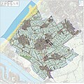
Gem-Westland-OpenTopo.jpg 4,925 × 4,818; 3.35 MB
-
Kadastrale kaart verzamelplan gemeente Groeneveld.jpg 12,052 × 7,836; 12.65 MB
-
LocatieWestland.png 280 × 130; 10 KB
-
Map - NL - Municipality code 1783 (2009).svg 300 × 160; 530 KB
-
Map - NL - Westland (2009).svg 625 × 575; 3.03 MB
-
Map gemeente Westland en Midden-Delfland.jpg 876 × 741; 185 KB
-
N213.PNG 557 × 435; 201 KB
-
N220.PNG 559 × 477; 220 KB
-
Natura2000 - Solleveld & Kapittelduinen.png 2,016 × 2,267; 438 KB
-
NL - locator map municipality code GM1783 (2016).png 2,125 × 1,417; 380 KB
-
OV Verdilaan.png 5,209 × 3,343; 7.72 MB
-
Topografie-gem-Westland.jpg 2,684 × 2,693; 3.38 MB
-
Westland WSM OpenStreetMap.png 1,623 × 1,786; 4.57 MB
-
Westland WSM.png 1,623 × 1,786; 183 KB
-
Tramlijn Loosduinen - Poeldijk.png 1,433 × 1,060; 2.32 MB
-
Tramlijn Poeldijk - Hoek van Holland.png 1,572 × 1,079; 2.02 MB
-
Tramlijn Poeldijk - Maaslandse Dam.png 1,434 × 1,027; 1.68 MB
-
Westland Openstreetmap kaart.png 1,623 × 1,786; 3.58 MB
-
WL baakwoning.png 453 × 577; 74 KB
-
WL de driesprong.png 861 × 679; 105 KB
-
WL mariendijk.png 883 × 635; 99 KB
-
WL nieuwe tuinen.png 1,097 × 563; 132 KB
-
WL rolpaal.png 675 × 469; 62 KB
-
WL westerlee.png 731 × 491; 131 KB
-
Zandmotor op Openstreetmap.png 1,387 × 1,128; 652 KB


