Category:Maps of Western Armenia
Jump to navigation
Jump to search
Media in category "Maps of Western Armenia"
The following 26 files are in this category, out of 26 total.
-
Armenia by the Sevres Treaty 1920.png 2,369 × 1,478; 479 KB
-
Armenian presence within modern Turkish borders in early 1600s.png 1,636 × 984; 82 KB
-
Armenian reform package in Ottoman Empire 1912-1914.png 1,822 × 1,123; 156 KB
-
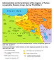
ATD of the regions of Turkey occupied by Russian troops during WW1.png 1,232 × 1,352; 191 KB
-
Autonomus Armenian province project 1913.png 3,612 × 1,432; 773 KB
-
Bitlis vilayet map Armenian.jpg 1,565 × 1,575; 1.13 MB
-
Boundary between Turkey and Armenia as determined by Woodrow Wilson 1920.jpg 2,239 × 2,204; 8.19 MB
-
Location of the 1894 and 1904 Sasun uprisings.png 942 × 609; 44 KB
-
Projet de province arménienne - Empire ottoman (1913).png 1,764 × 1,328; 338 KB
-
Projet de réformes en Arménie ottomane (1914).png 882 × 663; 64 KB
-
Sebastia vilayet map with armenian.png 1,875 × 2,150; 1.65 MB
-
Trapizon vilayet armenian.jpg 2,942 × 1,767; 2.34 MB
-
United Armenia.png 1,715 × 961; 145 KB
-
Van vilayet in armenian.png 2,905 × 3,484; 4.38 MB
-
Western Armenia and Cilicia.png 1,636 × 984; 56 KB
-
Western Armenia September 1917 hu.png 1,130 × 771; 192 KB
-
Western Armenia September 1917-ar.png 1,130 × 771; 70 KB
-
Western Armenia September 1917.png 1,130 × 771; 89 KB
-
Western Armenia ua.png 800 × 449; 135 KB
-
Western Armenia.png 800 × 449; 119 KB
-
Zayonchkovsky map36.png 3,999 × 2,818; 20.4 MB
-
Χάρτης της Πρώτης Δημοκρατίας της Αρμενίας.jpg 823 × 679; 213 KB
-
Западная Армения, 1917 г.png 1,130 × 771; 86 KB
-
Карта размещения армянского населения в 1914 г.jpg 5,445 × 5,225; 6.9 MB
-
Район освобождённой от турок русскими войсками Армении к лету 1916. Нива №31-1916.jpg 2,893 × 2,307; 879 KB


