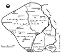
Category:Maps of Walcheren
Jump to navigation
Jump to search
Subcategories
This category has the following 4 subcategories, out of 4 total.
Media in category "Maps of Walcheren"
The following 8 files are in this category, out of 8 total.
-
2013-Top33-Walcheren.jpg 3,026 × 2,445; 3.28 MB
-
Admiralty Chart No 1872 Dunkerque to Flushing, Published 1962, Large Corrections 1972.jpg 16,485 × 11,256; 11.02 MB
-
Admiralty Chart No 1872 Dunkerque to Flushing, Published 1962, New Edition 1966.jpg 16,407 × 11,260; 26.33 MB
-
LocatieWalcheren.png 280 × 130; 17 KB
-
Natuur-Walcheren-2014Q1.jpg 6,380 × 5,750; 12.01 MB
-
Topografie-Walcheren.jpg 3,430 × 3,087; 3.12 MB
-
Walcheren-natuur-OpenTopo.jpg 8,520 × 7,464; 21.45 MB
-
Waterschap Walcheren.png 733 × 640; 148 KB


