Category:Maps of Vitré (Ille-et-Vilaine)
Jump to navigation
Jump to search
Wikimedia category | |||||
| Upload media | |||||
| Instance of | |||||
|---|---|---|---|---|---|
| Category combines topics | |||||
| Vitré | |||||
commune in Ille-et-Vilaine, France | |||||
| Instance of | |||||
| Location |
| ||||
| Located in or next to body of water | |||||
| Head of government |
| ||||
| Population |
| ||||
| Area |
| ||||
| Elevation above sea level |
| ||||
| official website | |||||
 | |||||
Media in category "Maps of Vitré (Ille-et-Vilaine)"
The following 17 files are in this category, out of 17 total.
-
35-AAV2020-Vitré.png 3,519 × 2,930; 2.13 MB
-
35-Vitré-AAV2020.png 3,519 × 2,930; 1.37 MB
-
35360-Vitré-Hydro.jpeg 5,846 × 4,133; 3.03 MB
-
35360-Vitré-Sols.png 3,270 × 2,598; 4.01 MB
-
Canton de Vitré(Est-Ouest)(Position).PNG 418 × 314; 39 KB
-
Carte du Jardin parc de Vitré.JPG 894 × 472; 59 KB
-
Carte ecomobilité de Vitré.JPG 848 × 525; 115 KB
-
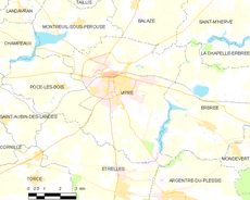
Map commune FR insee code 35360.png 756 × 605; 63 KB
-
Plan des remparts de Vitré.png 1,030 × 587; 298 KB
-
Vitré au IIIe siècle avant JC.jpg 583 × 564; 25 KB
-
Vitré au milieu du XIXe siècle.jpg 583 × 564; 28 KB
-
Vitré au Néolithique.jpg 581 × 565; 25 KB
-
Vitré au Xe siècle.jpg 581 × 564; 26 KB
-
Vitré avant toute occupation humaine.jpg 581 × 564; 23 KB
-
Vitré en 2010.jpg 583 × 564; 29 KB
-
Vitré à l'époque moderne.jpg 582 × 563; 26 KB


