Category:Maps of Villeurbanne
Jump to navigation
Jump to search
Wikimedia category | |||||
| Upload media | |||||
| Instance of | |||||
|---|---|---|---|---|---|
| Category combines topics | |||||
| Villeurbanne | |||||
commune in the metropolis of Lyon, France | |||||
| Pronunciation audio | |||||
| Instance of | |||||
| Part of | |||||
| Location | |||||
| Located in or next to body of water | |||||
| Head of government |
| ||||
| Population |
| ||||
| Area |
| ||||
| Elevation above sea level |
| ||||
| official website | |||||
 | |||||
Media in category "Maps of Villeurbanne"
The following 17 files are in this category, out of 17 total.
-
1C 162 Carte du Rhone de Lyon à Villeurbanne.jpg 6,670 × 2,716; 14.51 MB
-
69266-Villeurbanne-Hydro.jpeg 5,846 × 4,133; 4.24 MB
-
69266-Villeurbanne-Sols.png 3,270 × 2,598; 7.66 MB
-
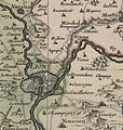
Bresse Bugey Valromay Dombes Viennois 169x (cropped - Zoom on Lyon).jpg 1,318 × 1,391; 651 KB
-
Carte etat major Villeurbanne.jpg 1,243 × 900; 237 KB
-
Carte1950 villeurbanne.jpg 1,155 × 908; 343 KB
-
Cassini Villeurbanne.jpg 1,223 × 858; 142 KB
-
Cimetières ancien et nouveau de Villeurbanne.png 608 × 474; 363 KB
-
Grand Lyon Villeurbanne.jpg 433 × 600; 60 KB
-
Géolocalisation Villeurbanne.jpg 514 × 463; 107 KB
-
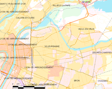
Map commune FR insee code 69266.png 756 × 605; 111 KB
-
Route de Genas Velodrome, Old Map of Lyon, Villeurbanne.jpg 1,698 × 1,090; 327 KB
-
Villeurbanne - Plan des rues 2020 - Quart nord-est.svg 1,813 × 2,250; 11.27 MB
-
Villeurbanne - Plan des rues 2020 - Quart nord-ouest.svg 1,813 × 2,000; 12.54 MB
-
Villeurbanne - Plan des rues 2020 - Quart sud-est.svg 2,563 × 2,150; 9.67 MB
-
Villeurbanne - Plan des rues 2020 - Quart sud-ouest.svg 2,613 × 2,250; 11.01 MB
-
Villeurbanne vers 1908.jpg 1,546 × 1,948; 924 KB


