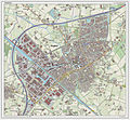
Category:Maps of Veghel
Jump to navigation
Jump to search
Wikimedia category | |||||
| Upload media | |||||
| Instance of | |||||
|---|---|---|---|---|---|
| Category combines topics | |||||
| Veghel | |||||
former municipality in the Netherlands | |||||
| Pronunciation audio | |||||
| Instance of |
| ||||
| Location | North Brabant, Netherlands | ||||
| Located in or next to body of water | |||||
| Capital | |||||
| Dissolved, abolished or demolished date |
| ||||
| Population |
| ||||
| Elevation above sea level |
| ||||
| Replaced by | |||||
| official website | |||||
 | |||||
Subcategories
This category has the following 2 subcategories, out of 2 total.
O
- Old maps of Veghel (5 F)
Media in category "Maps of Veghel"
The following 39 files are in this category, out of 39 total.
-
2013-Veghel.jpg 2,390 × 2,127; 2.8 MB
-
BAG woonplaatsen - Gemeente Veghel.png 2,419 × 2,419; 618 KB
-
EconomischGeografischGebied 112MiddenMeijerij.png 375 × 204; 10 KB
-
Gem-Veghel-2014Q1.jpg 4,630 × 4,137; 7.25 MB
-
Gem-Veghel-BAG-Woonplaats-BebouwdeKom-OpenTopo.jpg 5,641 × 5,080; 16.41 MB
-
Gem-Veghel-IBIS-Werklocaties-OpenTopo-3x2.jpg 3,800 × 2,533; 9.02 MB
-
Gem-Veghel-IBIS-Werklocaties-OpenTopo.jpg 5,641 × 5,080; 15.89 MB
-
Gem-Veghel-OpenTopo.jpg 5,641 × 5,080; 10.4 MB
-
Gem-Veghel-WoonplaatsVeghel-OpenTopo.jpg 4,167 × 5,082; 13.7 MB
-
Map - NL - 2014 - Veghel - Woonplaats 2826 Erp - Kerngebied WK086004 Erp.png 1,280 × 1,280; 193 KB
-
Map - NL - 2014 - Veghel - Woonplaats 2826 Erp.png 1,280 × 1,280; 79 KB
-
Map - NL - 2014 - Veghel - Woonplaats 2827 Veghel - Kerngebied WK086000 Veghel.png 1,280 × 1,280; 182 KB
-
Map - NL - 2014 - Veghel - Woonplaats 2827 Veghel.png 1,280 × 1,280; 79 KB
-
Map - NL - Municipality code 0860 (2009).svg 300 × 160; 530 KB
-
Map - NL - Veghel (2009).svg 625 × 575; 2.11 MB
-
Map - NL - Veghel - Woonplaats 2826 Erp - Kern 086004 Erp.png 1,169 × 1,237; 113 KB
-
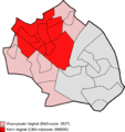
Map - NL - Veghel - Woonplaats 2827 Veghel - Kern 086000 Veghel.png 1,169 × 1,237; 122 KB
-
NL - locator map municipality code GM0860 (2016).png 2,125 × 1,417; 535 KB
-
Regio Uden-Veghel (Noord-Brabant, 2013) Cropped.jpg 2,205 × 2,205; 7.25 MB
-
Regio Uden-Veghel (Noord-Brabant, 2013).jpg 3,035 × 3,035; 13.37 MB
-
Uden-Veghel bevolkingsdichtheid (BAG).png 1,200 × 1,200; 51 KB
-
Uden-Veghel-Schijndel (Noord-Brabant, 2013).jpg 2,249 × 1,499; 4.1 MB
-
Veghel-Amert-OpenTopo.jpg 749 × 749; 674 KB
-
Veghel-BedrijventerreinDoornhoek-OpenTopo.jpg 680 × 680; 615 KB
-
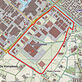
Veghel-BedrijventerreinDorshout-OpenTopo.jpg 500 × 500; 357 KB
-
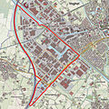
Veghel-Bunders-OpenTopo.jpg 790 × 790; 918 KB
-
Veghel-Centrum-OpenTopo.jpg 580 × 580; 538 KB
-
Veghel-Dubbelen-OpenTopo.jpg 1,420 × 1,420; 2.36 MB
-
Veghel-Eerde-OpenTopo.jpg 980 × 980; 1.13 MB
-
Veghel-Haven-OpenTopo-Cropped.jpg 720 × 540; 581 KB
-
Veghel-Haven-OpenTopo.jpg 1,016 × 1,016; 1.18 MB
-
Veghel-Mariaheide-OpenTopo.jpg 1,000 × 1,000; 1.14 MB
-
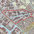
Veghel-OudeHaven-OpenTopo.jpg 579 × 579; 482 KB
-
Veghel-plaats-OpenTopo.jpg 1,821 × 1,683; 1.64 MB
-
Veghel-stad-2014Q1.jpg 1,821 × 1,637; 1.54 MB
-
Veghel-ThemaparkGarages-OpenTopo.jpg 250 × 250; 138 KB
-
Veghel-topografie.jpg 1,600 × 1,482; 1.6 MB
-
Veghel-West-OpenTopo.jpg 580 × 580; 493 KB
-
Veghel.jpg 2,500 × 3,064; 6.19 MB


