Category:Maps of Valencia
Jump to navigation
Jump to search
Wikimedia category | |||||
| Upload media | |||||
| Instance of | |||||
|---|---|---|---|---|---|
| Category combines topics | |||||
| Valencia | |||||
municipality in Spain, capital city of the Valencian Community  Seguint les agulles del rellotge, des de la part superior: Ciutat de les Arts i les Ciències, la Llotja, Plaça de la Reina amb la catedral al fons, Port, Platja del Cabanyal, l'edifici Iberdrola, i, a les 11, la Plaça de l'Ajuntament, amb els edificis blancs i la font. | |||||
| Instance of | |||||
| Part of | |||||
| Patron saint | |||||
| Location | Comarca de València, Province of Valencia, Valencian Community, Spain | ||||
| Located in or next to body of water | |||||
| Capital |
| ||||
| Official language | |||||
| Head of government |
| ||||
| Inception |
| ||||
| Population |
| ||||
| Area |
| ||||
| Elevation above sea level |
| ||||
| Replaces |
| ||||
| Different from | |||||
| official website | |||||
 | |||||
Subcategories
This category has the following 9 subcategories, out of 9 total.
Media in category "Maps of Valencia"
The following 42 files are in this category, out of 42 total.
-
Acequia de Vera Scavenging Plano OSM.pdf 1,752 × 1,239; 2.52 MB
-
Diocesisdevalencia.PNG 534 × 375; 16 KB
-
Districtes ciutat valencia.svg 596 × 843; 255 KB
-
Earth Europe Spain Valencia.jpg 1,094 × 729; 172 KB
-
Golf de València.PNG 800 × 543; 101 KB
-
Icona valència.gif 100 × 75; 2 KB
-
Junta Electoral Provincial de València.svg 144 × 184; 449 KB
-
Karte Gemeinde Valencia 2022.png 5,000 × 5,980; 2.61 MB
-
Localització de Ciutat de València respecte del País Valencià.png 238 × 400; 27 KB
-
Localització de Comarca de València.png 255 × 489; 7 KB
-
LocalizacionImagenes2013.png 800 × 800; 504 KB
-
Lvives-comollegar.svg 311 × 234; 29 KB
-
Map Puerto de valencia.png 274 × 283; 28 KB
-
Mapa de Partidos judiciales de la Comunidad Valenciana.png 4,961 × 7,016; 5.2 MB
-
Mapa del País Valencià.png 261 × 500; 25 KB
-
Mapa en relleu de la ciutat de València a la plaça dels Pinazo.jpg 4,608 × 3,072; 2.07 MB
-
MapCampusParty2006.png 2,400 × 1,700; 669 KB
-
MTN25-0696c3-1976-Burjasot-III (Burjassot).jpg 7,726 × 5,412; 7.48 MB
-
MTN25-0696c3-2003-Burjassot.jpg 7,726 × 5,412; 9.84 MB
-
MTN25-0722c1-1975-Valencia-I (Valencia).jpg 7,578 × 5,342; 7.71 MB
-
MTN25-0722c1-1986-Valencia.jpg 7,726 × 5,368; 7.3 MB
-
MTN25-0722c1-2000-Valencia.jpg 7,726 × 5,412; 9.71 MB
-
MTN25-0722c2-1975-Valencia-II (El Grao).jpg 7,726 × 5,412; 4.27 MB
-
MTN25-0722c2-1985-El Grao.jpg 7,726 × 5,396; 4.48 MB
-
MTN25-0722c2-2000-El Grao.jpg 7,726 × 5,412; 6.6 MB
-
MTN25-0722c2-2016-Valencia.jpg 9,843 × 5,214; 31.18 MB
-
MTN25-0722c4-1975-Valencia-IV (El Saler).jpg 7,726 × 5,412; 4.57 MB
-
MTN25-0722c4-2010-El Saler.jpg 7,874 × 5,167; 9.33 MB
-
Plano del distrito 5.png 656 × 656; 444 KB
-
Plano punto de encuentro.png 2,480 × 871; 2.37 MB
-
Poblats del Nord-zRótulos.png 1,639 × 975; 280 KB
-
Russafa's map.png 800 × 998; 414 KB
-
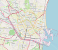
Valence (Espagne) OSM 01.png 1,000 × 847; 670 KB
-
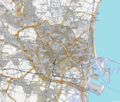
Valence (Espagne) OSM 02.png 1,000 × 847; 991 KB
-
Valencia - Mapa municipal.svg 778 × 413; 463 KB
-
Valencia location map.png 309 × 353; 133 KB
-
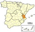
Valencia Province, Spain - location.png 256 × 233; 21 KB
-
Valencia, Spain - location.png 256 × 233; 21 KB
-
València, etc-Terme 1840.png 2,760 × 2,714; 1.6 MB
-
València, etc-Terme 1840.svg 2,761 × 2,705; 907 KB
-
València-JuntesMunicipals.png 1,823 × 3,342; 179 KB
Categories:
- Maps of cities in the Land of Valencia
- Geography of Valencia
- Maps of municipalities in the Land of Valencia
- Maps of municipalities of the Land of Valencia by comarca
- Maps of municipalities in the province of Valencia
- Maps of municipalities of Land of Valencia by comarca in Catalan
- Maps of municipalities of Land of Valencia by comarca in Spanish


