Category:Maps of Ukraine with some areas removed
Jump to navigation
Jump to search
Subcategories
This category has only the following subcategory.
Media in category "Maps of Ukraine with some areas removed"
The following 14 files are in this category, out of 14 total.
-
 Automobile codes of regions of Ukraine (2014–2022).png 1,181 × 825; 42 KB
-
 De-facto flag map of Ukraine (March 17, 2022).svg 512 × 327; 18 KB
-
 De-facto flag map of Ukraine (March 20, 2022).svg 512 × 317; 17 KB
-

-
 Flag map of Ukraine (April 17, 2022).svg 1,179 × 769; 35 KB
-
 Flag map of Ukraine with Russian-occupied territories omitted.svg 1,283 × 866; 60 KB
-
 Flag map of Ukraine without Crimea (2014–2022).svg 1,200 × 716; 121 KB
-
 Flag map of Ukraine, with Russian-occupied territory omitted.png 2,103 × 1,428; 62 KB
-
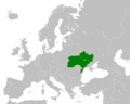
 Location Ukraine Europe New.png 2,056 × 1,800; 432 KB
-
 Russia administrative location map.svg 2,362 × 1,299; 8.32 MB
-
 Russian-ukrainian armed conflict English version.jpg 5,001 × 4,601; 3.75 MB
-
 Ukraine 2023.png 745 × 599; 156 KB
-
 Ukraine EU (with the Russian-occupied territories omitted).svg 1,283 × 866; 60 KB
-
 Региональные выборы на Украине 2015 - Донор.svg 1,453 × 866; 2.38 MB
.png)
.svg)
.svg)

.svg)

.svg)


.svg)
