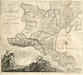
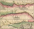
Category:Maps of Ukraine in the National Archives of Sweden
Jump to navigation
Jump to search
Maps held by Swedish National Archives of locations and places of current Ukraine.
Media in category "Maps of Ukraine in the National Archives of Sweden"
The following 31 files are in this category, out of 31 total.
-
1776 map of the Crimean peninsula.jpg 10,763 × 9,795; 11.04 MB
-
Carte de la Crimée pour suivre les opérations de la guerre d'orient.jpg 10,498 × 7,382; 6.14 MB
-
City of Poltava 1857 (cropped).jpg 5,690 × 7,433; 3.84 MB
-
City of Poltava 1857.jpg 5,756 × 8,012; 3.97 MB
-
Confluence of the rivers Southern Bug and Dnieper.jpg 7,586 × 2,944; 2.13 MB
-
Crop focusing on the Kiev Voivodeship in the Prototype of the "special" map of Ukraine.jpg 6,067 × 4,857; 1.65 MB
-
Detailed map of the Crimea peninsula in 1847 (cropped).jpg 8,103 × 5,560; 3.53 MB
-
Detailed map of the Crimea peninsula in 1847.jpg 8,153 × 6,028; 3.8 MB
-
Dnipro river map Guillaume le Vasseur de Beauplan.jpg 3,563 × 24,713; 6.08 MB
-
Hfen von Sewastopol (cropped).jpg 4,884 × 4,467; 1.87 MB
-
Hfen von Sewastopol.jpg 5,057 × 5,057; 2.04 MB
-
Historical map of Bakhmut in Ukraine (cropped).jpg 8,250 × 5,799; 3.26 MB
-
Kodak fortress.jpg 7,512 × 5,360; 2.6 MB
-
Map of Kherson c.1800.jpg 7,528 × 3,170; 4.39 MB
-
Map of Odessa military command.jpg 11,057 × 6,503; 6.99 MB
-
Map of the town and fortress of Ochakiv.jpg 3,980 × 3,092; 1.44 MB
-
Map of Ukraine, then Poland Russia and Crimean Khanate.jpg 8,468 × 6,090; 2.32 MB
-
Old map of Kyiv (cropped).jpg 8,562 × 5,715; 2.58 MB
-
Old map of Kyiv.jpg 8,585 × 6,300; 2.89 MB
-
Old map of Lviv (cropped).jpg 3,582 × 2,074; 488 KB
-
Old map of Lviv.jpg 3,582 × 2,616; 629 KB
-
Old map of Ukraine (cropped).jpg 6,515 × 5,828; 2.99 MB
-
Old map of Ukraine.jpg 6,515 × 6,287; 3.19 MB
-
Plan and map of the fortress of Okopy (cropped).jpg 6,363 × 5,096; 2.51 MB
-
Plan and map of the fortress of Okopy.jpg 6,482 × 5,777; 2.77 MB
-
Prototype of the "special" map of Ukraine (cropped).jpg 13,850 × 6,296; 3.66 MB
-
Prototype of the "special" map of Ukraine.jpg 13,850 × 6,891; 4.31 MB
-
Situs Leopoliensis. Per Fridericum Getkant recognitus. A 1635. Septemb.jpg 7,536 × 5,408; 1.7 MB
-
Tabula Geographica Ukrainska.jpg 7,552 × 5,408; 1.73 MB
-
Tractus Bonysthenis, vulgo Dnieper.jpg 6,417 × 5,473; 6.3 MB
-
Tshertosch ukrainskim i tsherkaskim gorodam ot Moskwij dokrijma.jpg 11,135 × 9,624; 12.04 MB


