Category:Maps of Ufa
Jump to navigation
Jump to search
Wikimedia category | |||||
| Upload media | |||||
| Instance of | |||||
|---|---|---|---|---|---|
| Category combines topics | |||||
| Ufa | |||||
capital city of the Republic of Bashkortostan, Russia .jpg)   | |||||
| Pronunciation audio | |||||
| Instance of |
| ||||
| Location |
| ||||
| Located in or next to body of water | |||||
| Highest judicial authority |
| ||||
| Official language | |||||
| Head of government |
| ||||
| Inception |
| ||||
| Population |
| ||||
| Area |
| ||||
| Elevation above sea level |
| ||||
| IATA airport code |
| ||||
| Different from | |||||
| official website | |||||
 | |||||
Media in category "Maps of Ufa"
The following 43 files are in this category, out of 43 total.
-
 Flag-map of Ufa.svg 438 × 667; 50 KB
-
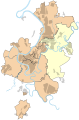
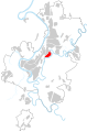
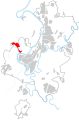
 Location of Ufa 01.svg 1,202 × 1,821; 345 KB
-
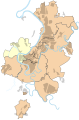
 Location of Ufa 02.svg 1,202 × 1,821; 345 KB
-
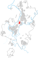
 Location of Ufa 03.svg 1,202 × 1,821; 345 KB
-
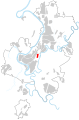
 Location of Ufa 04.svg 1,202 × 1,821; 345 KB
-
 Location of Ufa 05.svg 1,202 × 1,821; 345 KB
-
 Location of Ufa 06.svg 1,202 × 1,821; 345 KB
-
 Location of Ufa 07.svg 1,202 × 1,821; 345 KB
-
 Location of Ufa Chernikovka.svg 1,202 × 1,821; 398 KB
-
 Location of Ufa Glumilino.svg 1,202 × 1,821; 345 KB
-
 Location of Ufa INORS.svg 1,202 × 1,821; 345 KB
-
 Location of Ufa Krasnyi Yar.svg 1,202 × 1,821; 345 KB
-
 Location of Ufa NiGo.svg 1,202 × 1,821; 345 KB
-
 Location of Ufa Novoalexandrovka.svg 1,202 × 1,821; 345 KB
-
 Location of Ufa Novostroyka.svg 1,202 × 1,821; 345 KB
-
 Location of Ufa Shaksha.svg 1,202 × 1,821; 345 KB
-
 Location of Ufa Sipailovo.svg 1,202 × 1,821; 344 KB
-
 Location of Ufa SY ave.svg 1,202 × 1,821; 346 KB
-
 Location of Ufa Zaton.svg 1,202 × 1,821; 344 KB
-
 Map of Ufa.png 1,945 × 2,053; 2.57 MB
-
 Map of Zaton, Ufa, Bashkortostan, Russia.png 947 × 906; 188 KB
-
 Moscovia, 1596.jpg 1,141 × 859; 876 KB
-
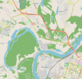
 OpenStreetMap Карта города Уфа.png 1,718 × 1,028; 603 KB
-
 Outline map of Ufa (with position on the map of Bashkortostan).svg 1,000 × 1,000; 2.84 MB
-
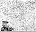
 Russian Empire 1745 (Map XIII HQ).jpg 9,238 × 8,251; 8.61 MB
-
 Ufa map division.svg 1,202 × 1,821; 386 KB
-
 Ufa peninsula.svg 974 × 974; 379 KB
-
 Ufa Plan 1876.jpg 800 × 1,012; 312 KB
-
 Ufa Plan 1908.jpg 2,000 × 2,667; 1.71 MB
-
 Ufa Plan 1925.jpg 1,000 × 737; 379 KB
-
 Ufa Plan 1939.jpg 6,027 × 4,469; 4.98 MB
-
 Ufa Province.jpg 1,400 × 1,257; 401 KB
-
 Ufa tram map 2022-05.svg 1,875 × 1,875; 1.1 MB
-
 Ufaineurope.png 979 × 758; 539 KB
-
 USSR map NN 40-4 -verso- Ufa and Vicinity.jpg 3,242 × 3,091; 2.46 MB
-
 Баланово — Ново-Александровка.jpg 4,715 × 3,041; 1.65 MB
-
 Население Уфы по районам, в % I.png 928 × 889; 152 KB
-
 Население Уфы по районам, в % II.png 928 × 889; 180 KB
-
 Схема микрорайона Белореченский (Уфа).jpg 1,500 × 1,047; 236 KB
-
 Схема размежевания микрорайона Новиковка (Уфа).jpg 793 × 610; 183 KB
-
 Улица Башкирской кавдивизии.png 523 × 511; 313 KB
-
 Уфимская провинция.jpg 1,400 × 1,457; 2.01 MB
-
 Этническая карта Уфы и Уфимского района.png 966 × 828; 202 KB


.svg)
.jpg)


.jpg)
.jpg)


