Category:Maps of Trémouilles
Jump to navigation
Jump to search
Wikimedia category | |||||
| Upload media | |||||
| Instance of | |||||
|---|---|---|---|---|---|
| Category combines topics | |||||
| Trémouilles | |||||
commune in Aveyron, France .jpg)   | |||||
| Instance of | |||||
| Location |
| ||||
| Population |
| ||||
| Area |
| ||||
| Elevation above sea level |
| ||||
| official website | |||||
 | |||||
Media in category "Maps of Trémouilles"
The following 11 files are in this category, out of 11 total.
-
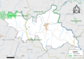
 12283-Trémouilles-Arron.png 3,057 × 2,480; 1.23 MB
-
 12283-Trémouilles-cadastre.svg 961 × 744; 6.61 MB
-
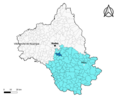
 12283-Trémouilles-Canton.png 3,057 × 2,480; 1.26 MB
-
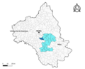
 12283-Trémouilles-EPCI.png 3,057 × 2,480; 1.26 MB
-
 12283-Trémouilles-Hydro.png 3,519 × 2,480; 2 MB
-
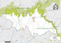
 12283-Trémouilles-Natura2000.png 7,039 × 4,960; 3.86 MB
-
 12283-Trémouilles-Sols.png 3,507 × 2,480; 2.13 MB
-
 12283-Trémouilles-ZNIEFF1.png 3,519 × 2,480; 1.74 MB
-
 12283-Trémouilles-ZNIEFF2.png 3,519 × 2,480; 1.71 MB
-
 12283-Trémouilles-Zone inondable.svg 1,070 × 744; 3.05 MB
-
 Map commune FR insee code 12283.png 756 × 605; 46 KB


