Category:Maps of Tierra del Fuego
Jump to navigation
Jump to search
Wikimedia category | |||||
| Upload media | |||||
| Instance of | |||||
|---|---|---|---|---|---|
| Category combines topics | |||||
| Tierra del Fuego | |||||
archipelago off the south of South America | |||||
| Instance of |
| ||||
| Part of | |||||
| Location | |||||
| Located in or next to body of water | |||||
| Has part(s) | |||||
| Highest point |
| ||||
| Population |
| ||||
| Area |
| ||||
| Elevation above sea level |
| ||||
 | |||||
Subcategories
This category has the following 5 subcategories, out of 5 total.
M
O
Media in category "Maps of Tierra del Fuego"
The following 43 files are in this category, out of 43 total.
-
1893 border protocol between Argentina & Chile.svg 694 × 589; 916 KB
-
21 Isla Dawson-O.jpg 3,495 × 2,259; 3.28 MB
-
Admiralty Chart Catalogue 1967 Page 104 Index S2.jpg 6,784 × 8,562; 9.39 MB
-
Admiralty Chart No 1332 Estrecho de Le Maire, Published 1962.jpg 8,191 × 11,283; 19.19 MB
-
AlgunasIslasAlSurDelCanalBeagle.png 429 × 363; 66 KB
-
AlgunasIslasAlSurDelCanalBeagleConLímite.png 429 × 363; 44 KB
-
AlgunasIslasASurDelCanalBeagle.jpg 650 × 652; 92 KB
-
ArchipielagoTDF-Aborígenes.svg 1,336 × 843; 143 KB
-
Canal-ballenero.svg 1,065 × 568; 413 KB
-
Cap horn.png 906 × 615; 58 KB
-
Cap horn2.png 906 × 546; 71 KB
-
CapeHornMap.png 508 × 616; 15 KB
-
Cities of Tierra del Fuego.png 519 × 475; 21 KB
-
Fuegio.png 504 × 477; 14 KB
-
Hosteisland.svg 1,425 × 969; 620 KB
-
Isla Grande de TDF-contorno.svg 906 × 672; 13 KB
-
Isla Grande de tierra del fuego-contorno.svg 790 × 586; 13 KB
-
Isla grande de tierra del fuego-politico.svg 792 × 698; 398 KB
-
Isla Grande de Tierra del Fuego.png 519 × 475; 28 KB
-
Kap Hoorn vs Magellanstr.jpg 2,200 × 1,650; 1.27 MB
-
Magallanes y Antártica Chilena location map (South American part) (+claims).svg 1,535 × 1,550; 830 KB
-
Magallanes y Antártica Chilena location map (South American part) (+claims, 1974).svg 1,535 × 1,550; 1.15 MB
-
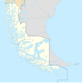
Magallanes y Antártica Chilena location map (South American part).svg 1,535 × 1,550; 831 KB
-
Map free PAIKE.JPG 800 × 490; 68 KB
-
Map of part of Tierra del Fuego Wellcome L0051065.jpg 6,728 × 4,590; 5.09 MB
-
Map of Tierra del Fuego Demis.png 1,129 × 886; 238 KB
-
Navarino Omora.JPG 496 × 246; 24 KB
-
Plano de Ushuaia.jpg 1,494 × 926; 723 KB
-
Protocolo de límites de 1893 entre Argentina y Chile.svg 694 × 589; 929 KB
-
Pueblos indígenas de la Patagonia Austral.svg 1,535 × 1,550; 881 KB
-
Riesco I.JPG 943 × 534; 82 KB
-
Strait of Magellan.jpeg 930 × 744; 120 KB
-
Terra del Fuoco.PNG 978 × 630; 43 KB
-
Tierra del Fuego adm location map.svg 1,616 × 1,600; 1.8 MB
-
Tierra del Fuego be.svg 1,326 × 843; 377 KB
-
Tierra del Fuego location map (no borders).svg 1,535 × 1,550; 853 KB
-
Tierra del Fuego location map 2.svg 1,251 × 847; 565 KB
-
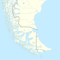
Tierra del Fuego location map.svg 1,535 × 1,550; 824 KB
-
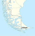
Tierra del Fuego location of Ushuaia.jpg 297 × 303; 81 KB
-
TierraDelFuego.JPG 770 × 578; 71 KB
-
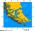
TierraDelFuego.PNG 963 × 619; 34 KB
-
TierraDelFuego1.PNG 963 × 619; 42 KB


