Category:Maps of Tibetan Plateau
Jump to navigation
Jump to search
Subcategories
This category has only the following subcategory.
Media in category "Maps of Tibetan Plateau"
The following 60 files are in this category, out of 60 total.
-
Topografic map of Tibetan Plateau.png 1,365 × 732; 663 KB
-
TE&II Vol 07 Fig 001.jpg 1,962 × 1,858; 374 KB
-
TE&II Vol 07 Fig 001b.jpg 1,702 × 1,323; 314 KB
-
1930 Map of the Republic of China.JPG 1,171 × 817; 272 KB
-
1939 Ouya Zongtu.jpg 3,510 × 2,717; 1.7 MB
-
1990、1995、2000、2005、2010和2015年青藏高原人类足迹数据样例.jpg 1,268 × 642; 246 KB
-
6.2 China Quake June 3.2007.png 478 × 372; 97 KB
-
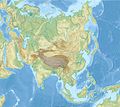
Asia laea relief location map.jpg 1,181 × 1,050; 1.23 MB
-
Buddhist sects.png 1,365 × 1,249; 236 KB
-
Buddhista kereskedelmi kapcsolatok I. század hu.png 2,383 × 1,048; 4.28 MB
-
Central Asian trade routes V2.jpg 1,280 × 836; 398 KB
-
Central Asian trade routes.jpg 954 × 674; 206 KB
-
China edcp relief location map Sichuan.png 1,968 × 1,567; 6.62 MB
-
China topo.png 1,200 × 804; 1.35 MB
-
China topo1.jpg 1,500 × 1,005; 1.26 MB
-
China topography full res.jpg 6,302 × 3,619; 4.72 MB
-
China-Historic macro areas.svg 1,438 × 1,047; 3.61 MB
-
ChinaGeography.png 1,119 × 795; 1.72 MB
-
Chinese No.109 Highway banner.JPG 3,872 × 554; 733 KB
-
DEMTibet annotated.png 3,145 × 1,763; 6.77 MB
-
DEMTibet.png 3,145 × 1,763; 8.73 MB
-
Ecoregion IM0402.svg 2,006 × 1,593; 5.55 MB
-
Equus hemionus carte.png 1,971 × 1,269; 218 KB
-
Equus hemionus map.png 1,329 × 1,032; 184 KB
-
Equus kiang map-ar.png 887 × 627; 109 KB
-
ExtentOfBuddhismAndTrade.jpg 3,489 × 1,760; 1.14 MB
-
Kamarupa 7th-8th Century AD.jpg 960 × 720; 485 KB
-
Kamarupa 7th-8th Century Cities.jpg 960 × 720; 493 KB
-
Kochueuti Kalmaki - Tibet Tangutiæ Pars alias Lasa Regnum.jpg 1,139 × 741; 196 KB
-
Major endorheic basins.png 1,253 × 648; 46 KB
-
Map of Central Asia with trade routes and movements, von Richthofen.png 2,034 × 1,227; 4.8 MB
-
Map of Tibet detail from China old map 1936 (cropped).jpg 504 × 391; 115 KB
-
Ming Dynasty 1415 chinese.png 556 × 537; 94 KB
-
Ming Dynasty 1415.png 556 × 537; 92 KB
-
Mongolei-SinkiangTxt.png 1,023 × 606; 1.14 MB
-
MtKailash location.png 980 × 615; 964 KB
-
Old map of India, from the British Library.jpg 2,034 × 3,021; 1.35 MB
-
Pantholops hodgsonii distribution bw.png 1,259 × 944; 1.84 MB
-
Pantholops hodgsonii distribution.png 1,259 × 944; 2.49 MB
-
Physical map of Tibet.png 833 × 490; 446 KB
-
Plateau Pika area.png 290 × 303; 9 KB
-
Procapra picticaudata map.png 407 × 388; 16 KB
-
Radhanites2.png 1,201 × 601; 1.41 MB
-
Route rubrouck 1253 55.JPG 760 × 324; 57 KB
-
Sivallik Hills map.svg 3,099 × 2,868; 6.99 MB
-
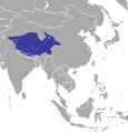
Snow leopard range.png 965 × 943; 42 KB
-
Tibet and India map detail, from- LA2-Blitz-0103 (cropped).jpg 353 × 274; 46 KB
-
TibetanPlateau.jpg 720 × 481; 329 KB
-
TibetanPlateauTectonics.png 3,422 × 2,055; 12.1 MB
-
Viagem do Japao.png 1,021 × 656; 701 KB
-
Vulpes ferrilata distribution map.svg 1,181 × 940; 2.56 MB
-
Yangtze River drainage basin map.svg 943 × 498; 9.6 MB
-
Zheng He.png 977 × 619; 918 KB
-
西遼.png 2,231 × 1,171; 4.62 MB
-
鮮卑帝国.png 2,549 × 1,700; 2.07 MB


