Category:Maps of Tegelen
Jump to navigation
Jump to search
Wikimedia category | |||||
| Upload media | |||||
| Instance of | |||||
|---|---|---|---|---|---|
| Category combines topics | |||||
| Tegelen | |||||
village in Venlo, Netherlands | |||||
| Instance of | |||||
| Location |
| ||||
| Dissolved, abolished or demolished date |
| ||||
| Population |
| ||||
| Replaced by | |||||
| Different from | |||||
 | |||||
Media in category "Maps of Tegelen"
The following 12 files are in this category, out of 12 total.
-
Tegelen in the postal route system of the French First Republic.jpg 1,021 × 905; 267 KB
-
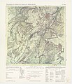
TrK33 Venlo.jpg 2,541 × 2,951; 1.21 MB
-
Overzicht Venlo met omliggende dorpen.jpg 4,202 × 5,600; 4.22 MB
-
1850 Kaart van het stroomgebied van de Maas bij Tegelen.jpg 4,712 × 3,351; 4.59 MB
-
Tegelen 1861.jpg 3,141 × 1,706; 1.75 MB
-
1867 Tegelen.jpg 1,483 × 1,639; 1.52 MB
-
Map VenloNL GTegelen.PNG 425 × 599; 79 KB
-
Map VenloNL Tegelen kernen.PNG 170 × 170; 2 KB
-
Map VenloNL Tegelen wijken.PNG 170 × 170; 3 KB
-
Narrow gauge and main lines Tegelen.png 3,117 × 2,261; 5.68 MB


