Category:Maps of Teatinos-Universidad
Jump to navigation
Jump to search
Districts of Málaga: Bailén-Miraflores · Campanillas · Carretera de Cádiz · Centro · Churriana · Ciudad Jardín · Cruz de Humilladero · Este · Palma-Palmilla · Puerto de la Torre · Teatinos-Universidad
Media in category "Maps of Teatinos-Universidad"
The following 6 files are in this category, out of 6 total.
-
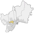
Distrito Teatinos-Universidad.svg 971 × 943; 484 KB
-
Bulevarlouispasteurlocate.svg 1,000 × 971; 78 KB
-
Cañadacardos.svg 3,264 × 2,263; 482 KB
-
LocalizaciónPlutarco.svg 1,000 × 971; 78 KB
-
Locatorhaciendabizcochero.svg 3,264 × 2,263; 650 KB
-
Mapa de Hacienda Bizcochero (2019.jpg 905 × 533; 85 KB


