Category:Maps of Třebíč
Jump to navigation
Jump to search
Wikimedia category | |||||
| Upload media | |||||
| Instance of | |||||
|---|---|---|---|---|---|
| Category combines topics | |||||
| Třebíč | |||||
town in Vysočina Region, Czech Republic | |||||
| Instance of |
| ||||
| Location |
| ||||
| Located in or next to body of water | |||||
| Diocese | |||||
| Official language | |||||
| Head of government |
| ||||
| Has part(s) |
| ||||
| Legal form | |||||
| Founded by | |||||
| Inception |
| ||||
| Highest point |
| ||||
| Population |
| ||||
| Area |
| ||||
| Elevation above sea level |
| ||||
| Different from | |||||
| official website | |||||
 | |||||
Maps of Třebíč
[edit]Maps of the West Moravian centre in the Czech Republic
Subcategories
This category has the following 2 subcategories, out of 2 total.
E
- Election maps of Třebíč (10 F)
M
- Maps of Borovina (13 F)
Media in category "Maps of Třebíč"
The following 63 files are in this category, out of 63 total.
-
Location of Czech city Trebic.png 256 × 150; 18 KB
-
Map cz Třebíč kroton.svg 1,052 × 744; 116 KB
-
Map of MHD Třebíč of January 1 2019.svg 512 × 362; 51 KB
-
Map of MHD Třebíč of January 2019.svg 512 × 362; 54 KB
-
Mapy.cz - turistická mapa - Borovinský rybník.png 1,656 × 938; 988 KB
-
Obr. 22. Obvod města Třebíče, Žid. města a Podklášteří.png 4,663 × 2,148; 2.31 MB
-
Tr-borovina006.svg 955 × 639; 50 KB
-
Tr-castle001.svg 1,081 × 765; 70 KB
-
TR3 tyn valley commons.svg 1,197 × 1,317; 209 KB
-
TR3.1 Trebic clear.svg 1,926 × 900; 426 KB
-
TR3.1 Trebic I-23.svg 1,926 × 900; 530 KB
-
TR3.1 Trebic physical map.svg 1,925 × 899; 297 KB
-
TR3.1 Trebic transport.svg 1,926 × 900; 528 KB
-
TR3.1 trolleybuses commons.svg 1,923 × 899; 317 KB
-
Trebic area evolution 300px replaced.gif 300 × 199; 136 KB
-
Trebic area evolution 300px.gif 300 × 199; 40 KB
-
Trebic horka tyrs gardens.svg 1,061 × 592; 85 KB
-
Trebic jejkov 1978.svg 1,401 × 982; 111 KB
-
Trebic jejkov 2005.svg 1,401 × 982; 101 KB
-
Trebic jejkov klaster 1921.svg 701 × 558; 24 KB
-
Trebic jejkov klaster 1930.svg 701 × 558; 25 KB
-
Trebic jejkov klaster 2007.svg 700 × 558; 26 KB
-
Trebic jejkov prehledka.svg 676 × 638; 44 KB
-
Trebic libusino udoli commons.svg 818 × 785; 30 KB
-
Trebic mc borovina.svg 829 × 979; 74 KB
-
Trebic mc budikovice.svg 829 × 979; 74 KB
-
Trebic mc horka-domky.svg 829 × 979; 74 KB
-
Trebic mc jejkov.svg 829 × 979; 74 KB
-
Trebic mc nove dvory.svg 829 × 979; 74 KB
-
Trebic mc nove mesto.svg 829 × 979; 74 KB
-
Trebic mc old colors.svg 829 × 979; 88 KB
-
Trebic mc pocoucov.svg 829 × 979; 74 KB
-
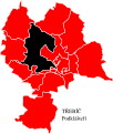
Trebic mc podklasteri.svg 829 × 979; 74 KB
-
Trebic mc ptacov.svg 829 × 979; 74 KB
-
Trebic mc racerovice.svg 829 × 979; 74 KB
-
Trebic mc ripov.svg 829 × 979; 74 KB
-
Trebic mc slavice.svg 829 × 979; 74 KB
-
Trebic mc sokoli.svg 829 × 979; 74 KB
-
Trebic mc starecka.svg 829 × 979; 74 KB
-
Trebic mc tyn.svg 829 × 979; 74 KB
-
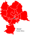
Trebic mc vnitrni mesto.svg 829 × 979; 74 KB
-
Trebic mc zamosti.svg 829 × 979; 74 KB
-
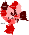
Trebic mc.svg 829 × 979; 89 KB
-
Trebic nove mesto east 1985.svg 1,201 × 1,906; 31 KB
-
Trebic nove mesto east 2008.svg 1,201 × 1,906; 25 KB
-
Trebic nove mesto prehledka.svg 349 × 452; 22 KB
-
Trebic parishes.svg 687 × 746; 69 KB
-
Trebic podklasteri castle basilica-HE.svg 1,081 × 765; 15 KB
-
Trebic podklasteri castle basilica.svg 1,081 × 765; 15 KB
-
Trebic podklasteri jewish cemetery.svg 888 × 662; 38 KB
-
Trebic starecka krajickuv mlyn.svg 708 × 518; 26 KB
-
Trebic vnitrni mesto 1835.svg 1,062 × 522; 120 KB
-
Trebic vnitrni mesto map 2004.svg 1,064 × 527; 76 KB
-
Trebic zamosti.svg 1,562 × 751; 106 KB
-
Třebíč Borovina municipal assembly election 2006.svg 802 × 618; 335 KB
-
Třebíč Borovina regional assembly election 2008.svg 802 × 618; 335 KB
-
Třebíč, mapa centra.jpg 3,629 × 5,013; 3.49 MB
-
Třebíč, Po stopách opatů a rabínů, Nad Zámkem (01).jpg 5,184 × 3,888; 6.15 MB
-
Třebíč, Po stopách opatů a rabínů, Nad Zámkem.jpg 3,888 × 5,184; 6.82 MB
-
Třebíč-Týn, Táborská, plán Třebíče (01).jpg 5,184 × 3,888; 6.63 MB
-
Třebíč-Týn, Táborská, plán Třebíče.jpg 3,888 × 5,184; 6.84 MB
-
Zastavovací plán města Třebíče, 1932.jpg 1,737 × 1,059; 417 KB
-
Znázornění oblasti týnských rybníků a Baráku.jpg 3,888 × 5,184; 5.04 MB


