Category:Maps of Syrian Kurdistan
Jump to navigation
Jump to search
Subcategories
This category has only the following subcategory.
Pages in category "Maps of Syrian Kurdistan"
This category contains only the following page.
Media in category "Maps of Syrian Kurdistan"
The following 80 files are in this category, out of 80 total.
-
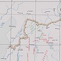
1896 map of Syrian Kurdistan.jpg 4,964 × 2,393; 1.28 MB
-
1951 CIA map of Syria – principal Arab and Kurdish tribes, 1951 (margins cropped).jpg 5,260 × 4,244; 3.79 MB
-
1951 CIA map of Syria – principal Arab and Kurdish tribes, 1951.jpg 5,868 × 4,776; 2.5 MB
-
Siege of Kobane.svg 1,850 × 1,229; 466 KB
-
Strikes in Syria and Iraq 2014-09-23 (cropped).jpg 940 × 704; 106 KB
-
Strikes in Syria and Iraq 2014-09-23.jpg 953 × 715; 114 KB
-
Siege of Kobani frontline progression, from October 2014 to January 2015-ar.jpg 1,333 × 705; 224 KB
-
Siege of Kobani frontline progression, from October 2014 to January 2015.jpg 1,333 × 705; 544 KB
-
Siege of Kobanê.svg 1,263 × 745; 1.02 MB
-
Front Kobané octobre 2014.png 1,024 × 604; 271 KB
-
Syrian civil war 24-11-14.png 2,500 × 2,066; 919 KB
-
Syrian civil warmap.png 2,500 × 2,066; 938 KB
-
A'zaz District.png 620 × 541; 52 KB
-
Ain al-Arab am 13 September 2014-ar.png 429 × 222; 30 KB
-
Ain al-Arab am 13 September 2014.png 429 × 222; 25 KB
-
Al-Hasakah Governorate farthest ISIL advance, mid-April 2015.png 1,070 × 666; 110 KB
-
Al-Hasakah Governorate post-offensive, on May 31, 2015.png 1,072 × 666; 113 KB
-
Al-Hasakah offensive in progress, February 24, 2015.jpg 1,052 × 672; 248 KB
-
Al-Hawl and Sinjar offensives (2015) map.png 1,040 × 1,074; 243 KB
-
Ayn Al Arab District.png 620 × 541; 51 KB
-
Battle of Al-Hasakah (Summer 2015).png 3,197 × 2,217; 1.26 MB
-
Battle of Hasakah.svg 2,999 × 2,079; 2.5 MB
-
Cantones del Rojava.jpeg 3,300 × 2,550; 1.22 MB
-
Syria and Iraq 2014-onward War map.png 4,501 × 3,439; 1.75 MB
-
Syrian, Iraqi, and Lebanese insurgencies.png 4,509 × 3,449; 1.74 MB
-
Syrian, Iraqi, and Lebanese insurgencies.svg 1,538 × 1,161; 4.83 MB
-
Claimed and de facto territory of Rojava.png 2,000 × 1,653; 277 KB
-
De facto cantons of Rojava-ar.png 2,000 × 1,653; 277 KB
-
De facto cantons of Rojava.png 2,000 × 1,653; 268 KB
-
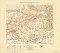
Eastern Turkey in Asia. Sheet 25. Mardin.jpg 10,625 × 9,495; 15.34 MB
-
Kobane front estimated 30102014.svg 750 × 510; 12 KB
-
Kobane Mashtanour.svg 500 × 688; 17 KB
-
Kobani Canton post-siege, April 29, 2015.jpg 414 × 324; 72 KB
-
Kurd mountain.jpg 4,525 × 2,983; 6.6 MB
-
Kurdish tribes in 1919 (Syrian Kurdistan).jpg 2,231 × 1,018; 241 KB
-
Kurdistan Occidental copy.jpg 1,200 × 991; 384 KB
-
Map detail showing Syrian Kurdistan in 1935.jpg 6,301 × 2,857; 2.27 MB
-
Map of Akcakale and Tell Abyad.jpg 640 × 360; 31 KB
-
Map of DFNS late 2017 AFRIN EUPHRATES JAZIRA ONLY.svg 921 × 761; 181 KB
-
Map of Rojava cantons march 22.png 2,000 × 1,653; 243 KB
-
Northern Syria offensive (2015).png 1,544 × 1,083; 340 KB
-
Regions of the Autonomous Administration of North and East Syria.png 2,000 × 1,653; 243 KB
-
Rojava (orthographic projection).svg 553 × 553; 444 KB
-
Rojava Cantons.svg 1,488 × 1,053; 453 KB
-
Rojava Kurdisch kontrollierte Gebiete.jpg 2,036 × 678; 146 KB
-
Rojava Kurdisch kontrollierte Gebiete.png 2,041 × 682; 368 KB
-
Rojava location map.svg 928 × 367; 130 KB
-
Rojava map (including Turkish occupied territories).png 1,024 × 1,024; 456 KB
-
Rojava.svg 1,488 × 1,053; 486 KB
-
Rojava february 2014.png 1,124 × 519; 42 KB
-
Rojava june 2015.png 1,124 × 519; 43 KB
-
Northern Syria - Rojava october 2016.png 1,124 × 519; 49 KB
-
Rojava february2014 2-ar.png 3,903 × 1,802; 413 KB
-
Rojava february2014 2.png 1,124 × 519; 39 KB
-
Rojava february2014.png 1,124 × 569; 54 KB
-
Rojava februar 2014.png 1,152 × 648; 44 KB
-
Rojava march 2016.png 800 × 405; 110 KB
-
Siege Of Afrin.svg 437 × 600; 137 KB
-
Syrian civil war 18 November.png 2,496 × 2,061; 730 KB
-
Syrian civil war 2.png 2,500 × 2,066; 937 KB
-
Syrian civil war 25-05-14.png 2,496 × 2,061; 705 KB
-
Syrian civil war 5 October 2014.png 2,500 × 2,066; 935 KB
-
Syrian civil war map.png 2,496 × 2,061; 728 KB
-
Syrian civil war september 2014.png 2,500 × 2,066; 931 KB
-
Syrian war map 11 7 14.png 2,496 × 2,061; 702 KB
-
Syrian war map 17 8 14.png 2,496 × 2,061; 701 KB
-
Syrian war map 18 6 14.png 2,496 × 2,061; 704 KB
-
Tell Abyad offensive (2015).png 679 × 464; 112 KB
-
Tell Abyad region on May 31, 2015.png 679 × 464; 119 KB
-
Tell Abyad region post-offensive.png 679 × 464; 66 KB
-
The situation in Afrin district.svg 437 × 600; 127 KB
-
The Situation in Hasakah.svg 600 × 313; 524 KB


