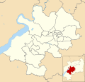
Category:Maps of Stroud District
Jump to navigation
Jump to search
Media in category "Maps of Stroud District"
The following 5 files are in this category, out of 5 total.
-
GloucestershireStroud.png 200 × 160; 14 KB
-
Stroud UK locator map.svg 1,089 × 1,266; 1.09 MB
-
Stroud UK ward map 2010 (blank).svg 1,319 × 1,266; 703 KB
-
Stroud UK ward map 2016 (blank).svg 1,319 × 1,266; 735 KB
-
Stroud UK ward map 2024.svg 1,319 × 1,266; 743 KB


