Category:Maps of Southern Federal District
Jump to navigation
Jump to search
Subcategories
This category has the following 2 subcategories, out of 2 total.
Media in category "Maps of Southern Federal District"
The following 21 files are in this category, out of 21 total.
-
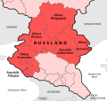
Karte Föderationskreis Südrussland.svg 1,201 × 1,132; 85 KB
-
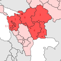
Okrug kavkaz.png 270 × 360; 6 KB
-
Outline Map of Southern Federal District (Crimea disputed).svg 1,136 × 872; 1.64 MB
-
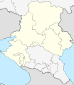
Outline Map of Southern Federal District.svg 600 × 540; 898 KB
-
Relief Map of Southern Federal District-(Crimea disputed).jpg 1,200 × 921; 550 KB
-
Relief Map of Southern Federal District.jpg 1,200 × 1,080; 287 KB
-
Relief Map of Southern Federal District.svg 600 × 540; 898 KB
-
Russland 2FK suedrussland map.png 787 × 708; 50 KB
-
Southern Federal District (2000-2010).svg 1,000 × 1,000; 83 KB
-
Southern Federal District (numbered).svg 1,136 × 872; 1.36 MB
-
Southern Federal District (numbered, 2014-2016, Crimea disputed).svg 1,000 × 1,000; 76 KB
-
Southern Federal District (numbered, 2014-2016, with Crimea).svg 1,000 × 1,000; 76 KB
-
Southern Federal District (numbered, 2016 composition, Crimea disputed).svg 1,136 × 872; 1.37 MB
-
Southern Federal District (numbered, without Crimea).svg 1,000 × 1,000; 72 KB
-
Southern Federal District (unnumbered).svg 1,136 × 872; 1.35 MB
-
Southern Federal District (unnumbered, 2016 composition, Crimea disputed).svg 1,136 × 872; 1.35 MB
-
Southern Federal District (Южный федеральный округ).svg 2,000 × 1,928; 462 KB
-
Southern Federal District.png 5,371 × 5,719; 2.64 MB
-
SouthernRussia.svg 600 × 695; 271 KB
-
ZuidelijkFederaalDistrictGenummerd.png 227 × 274; 6 KB


