Category:Maps of Southeastern Europe
Jump to navigation
Jump to search
Wikimedia category | |||||
| Upload media | |||||
| Instance of | |||||
|---|---|---|---|---|---|
| Category combines topics | |||||
| Southeast Europe | |||||
geographic region | |||||
| Instance of |
| ||||
| Part of | |||||
| Location | Europe, Northern hemisphere | ||||
| Has part(s) | |||||
 | |||||
Subcategories
This category has the following 4 subcategories, out of 4 total.
A
D
M
Media in category "Maps of Southeastern Europe"
The following 48 files are in this category, out of 48 total.
-
Southeastern-Europe-map.png 415 × 422; 12 KB
-
2015 Western Balkans Summit.png 1,198 × 1,000; 56 KB
-
2021-05-05 Donau.jpg 8,510 × 4,740; 6.24 MB
-
Adriatic Charter Map.png 606 × 570; 19 KB
-
Balkan general map.jpg 546 × 608; 92 KB
-
Balkan peninsula, geographic study, distances.svg 508 × 432; 855 KB
-
Balkans 1856-es.svg 4,120 × 5,720; 1 MB
-
Balkans 1878-es.svg 4,120 × 5,720; 1.05 MB
-
Balkans 1881-es.svg 4,120 × 5,720; 1.06 MB
-
Balkans Historical Aspirations Map 1912.png 754 × 600; 775 KB
-
Blank Map of Aegean Sea.svg 447 × 365; 277 KB
-
Central and Eastern Europe around 650 AD.png 572 × 388; 352 KB
-
Ducado.png 985 × 886; 555 KB
-
Eastern Federation map.png 2,048 × 1,426; 945 KB
-
Ethnographic-map-of-the-Balkans-1918.jpg 4,414 × 3,783; 3.25 MB
-
Geographic region of Balkans.png 2,925 × 2,233; 384 KB
-
Greater Greece Map Detail by John Bartholomew 1920.jpg 2,742 × 2,743; 2.68 MB
-
Greater South Europe.png 1,200 × 1,001; 25 KB
-
J. B. Homann - Danubii cum adiacentibus regnis.jpg 640 × 517; 141 KB
-
Landen in Zuidoost-Europa.PNG 231 × 250; 21 KB
-
Linguistic map of Eastern Europe, Max Müller, 1854.jpg 3,913 × 2,954; 3.4 MB
-
LocationSoutheasternEurope.PNG 680 × 520; 120 KB
-
Mapa.Igel greziarra.pdf 1,241 × 1,754; 345 KB
-
Maximum expansion of the Ottoman Empire in Europe.png 3,648 × 2,244; 278 KB
-
Mittelmeer-Lander nach dem 4. Kreuzzuge (1204).jpg 3,956 × 1,056; 2.28 MB
-
NI4OS Europe partner countries.png 3,121 × 2,633; 873 KB
-
Ottoman Empire1801.jpg 758 × 600; 445 KB
-
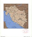
Outline map of Slovenia, Croatia, and Bosnia and Hercegovina. LOC 2005626534.jpg 2,548 × 2,917; 643 KB
-
Petachiah.png 656 × 391; 410 KB
-
Relixonnosbalcanes.PNG 300 × 267; 12 KB
-
South-eastern Europe 1040.jpg 1,122 × 867; 332 KB
-
Southeast Europe (definitions).png 6,460 × 3,403; 1.54 MB
-
Southeastern Europe.png 641 × 435; 23 KB
-
Southern Europe (definitions).png 6,460 × 3,403; 1.26 MB
-
Stability Pact For Southeastern Europe Map.svg 2,045 × 1,720; 762 KB
-
Sueosteuropa.png 383 × 229; 8 KB
-
Sueosteuropa2.png 383 × 229; 7 KB
-
Südosteuropa 3.JPG 641 × 435; 44 KB
-
The collapse of the Ottoman Empire.jpg 1,317 × 831; 675 KB
-
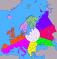
The division of Europe by cardinal directions.Center of Europe near Vilnius.png 2,200 × 2,300; 771 KB
-
UBBasel Map Balkanhalbinsel Italien Osmanisches Reich Südosteuropa 1686-1715 Kartenslg Mappe 250-10.tif 11,163 × 8,542, 2 pages; 272.84 MB
-
VeľkáVýchodnáSchízma.png 9,709 × 7,695; 1.06 MB
-
BASA-121K-1-367-14-Balkan Peninsula Map.jpeg 2,550 × 2,944; 1.1 MB
-
Југоисточна Европа.jpg 641 × 435; 77 KB


