Category:Maps of South Tyrol
Jump to navigation
Jump to search
Wikimedia category | |||||
| Upload media | |||||
| Instance of | |||||
|---|---|---|---|---|---|
| Category combines topics | |||||
| South Tyrol | |||||
autonomous province of Italy | |||||
| Instance of | |||||
| Part of | |||||
| Named after | |||||
| Location |
| ||||
| Capital | |||||
| Legislative body |
| ||||
| Executive body | |||||
| Official language | |||||
| Head of government |
| ||||
| Inception |
| ||||
| Population |
| ||||
| Area |
| ||||
| official website | |||||
 | |||||
Subcategories
This category has the following 12 subcategories, out of 12 total.
A
- Atlas Tyrolensis (34 F)
B
E
- Election maps of South Tyrol (35 F)
M
O
- Maps of Ötztal Alps (14 F)
P
S
- Maps of Sebatum (6 F)
W
Z
Media in category "Maps of South Tyrol"
The following 107 files are in this category, out of 107 total.
-
Bolzano posizione.png 350 × 424; 11 KB
-
Mappa regioni con movimenti indipendentisti.png 480 × 600; 75 KB
-
32 of 'Untrodden Peaks and Unfrequented Valleys. ... Second edition' (11205509866).jpg 2,432 × 3,562; 2.54 MB
-
2200 Piz Lad.jpg 14,000 × 9,600; 110.63 MB
-
2220 Glurns-Glorenza.jpg 14,000 × 9,600; 109.5 MB
-
2240 Müstair.jpg 14,000 × 9,600; 120.91 MB
-
55 of 'Om Forholdene ved Monzoni og Predazzo i Sydtyrol, etc' (11031760916).jpg 4,120 × 2,830; 1.57 MB
-
Alto Adige - Mappa.svg 550 × 325; 1.13 MB
-
Alto Adige Sbarrato.jpg 1,113 × 526; 495 KB
-
Alto Adige Voy Map.svg 550 × 325; 1.6 MB
-
Aree turistiche dell'Alto Adige - per Wikivoyage.png 800 × 483; 198 KB
-
Begebenheiten im Tyrol 00021 Stertzingen mit der Gegend auff 2 Stund.jpg 1,592 × 1,180; 1.33 MB
-
Begebenheiten im Tyrol 00027 Botzen.jpg 1,884 × 930; 1.41 MB
-
Begebenheiten im Tyrol 00029 Botzen mit der Gegend auf 2 Stunden.jpg 1,543 × 1,140; 902 KB
-
Bolzano-Den.jpg 1,500 × 982; 145 KB
-
Bolzano-Pop.jpg 1,500 × 982; 149 KB
-
Bolzano-Var.jpg 1,500 × 982; 141 KB
-
Burggrafenamt.png 670 × 842; 42 KB
-
Comuni e valli ladine.png 3,784 × 3,625; 1.04 MB
-
Comuni oltradige bassa atesina-gemeinden ueberetsch unterland.png 500 × 500; 97 KB
-
Comuni val venosta-gemeinden vinschgau.png 500 × 500; 75 KB
-
Comuni valle isarco-gemeinden eisacktal.png 500 × 500; 79 KB
-
Comuni wipptal-gemeinden wipptal.png 563 × 340; 40 KB
-
Comunità comprensoriali Alto Adige.png 1,095 × 661; 175 KB
-
Comunità comprensoriali Alto Adige.svg 1,095 × 661; 410 KB
-
Deutschnonsberg in South Tyrol.svg 1,037 × 686; 93 KB
-
Ethnic distribution in South Tyrol, 1880.svg 955 × 587; 2.28 MB
-
Ethnic Distribution South Tyrol Census 1880.png 1,800 × 1,314; 823 KB
-
Ethnic identity in and around Austria.1.png 1,690 × 930; 513 KB
-
Ethnic identity in and around Austria.jpg 1,690 × 930; 90 KB
-
Ferrovia del renon.png 957 × 715; 123 KB
-
Forstinspektorate (Südtirol).png 1,650 × 1,040; 232 KB
-
General map to illustrate Italian Alps (c 1875).jpg 4,240 × 3,125; 5.47 MB
-
Grup lenguisteg Sudtirol 2011.svg 1,056 × 705; 162 KB
-
Innsbruck - 29-47.jpg 3,442 × 4,960; 3.87 MB
-
ITA Campo Tures, Hotel Drumlerhof 010.jpg 4,010 × 3,024; 2.69 MB
-
Italy Bolzano-Bozen location IT map.svg 1,037 × 686; 167 KB
-
Italy Bolzano-Bozen location map.svg 1,037 × 686; 114 KB
-
Italy Bolzano-Bozen relief location map.jpg 1,037 × 686; 380 KB
-
Italy Trentino-Südtirol location map.svg 340 × 325; 317 KB
-
Karte Burggrafenamt.svg 1,037 × 686; 262 KB
-
Karte Drei Zinnen.png 589 × 589; 204 KB
-
Karte Gemeinde Vintl.png 1,085 × 1,463; 1.72 MB
-
Karte Passeiertal.png 686 × 501; 53 KB
-
Karte Passeiertal.svg 1,037 × 686; 265 KB
-
Karte Pustertal.png 686 × 501; 46 KB
-
Karte Pustertal.svg 1,037 × 686; 268 KB
-
Karte Salten-Schlern.png 686 × 501; 46 KB
-
Karte Salten-Schlern.svg 1,037 × 686; 268 KB
-
Karte Tierser Tal.svg 1,037 × 686; 266 KB
-
Karte Tiersertal.png 686 × 501; 46 KB
-
Karte Uebersicht Vintl.png 1,534 × 1,417; 2.99 MB
-
Karte Vinschgau.png 686 × 501; 46 KB
-
Karte Vinschgau.svg 1,037 × 686; 273 KB
-
Karte Welterbe Dolomiten.png 783 × 803; 1.03 MB
-
Karte Westliches Pustertal.png 1,534 × 1,417; 2.99 MB
-
Karte Wipptal.png 686 × 501; 46 KB
-
Karte Wipptal.svg 1,037 × 686; 262 KB
-
Karte Überetsch-Unterland.png 686 × 501; 46 KB
-
Karte3 Tauferer Ahrntal.png 685 × 487; 46 KB
-
Language distribution in South Tyrol, 2001.svg 955 × 587; 2.28 MB
-
Language distribution in South Tyrol, 2011.svg 955 × 587; 2.28 MB
-
Language distribution in South Tyrol, Italy 2001.png 1,800 × 1,314; 884 KB
-
Language distribution in South Tyrol, Italy 2011, de.png 1,800 × 1,417; 760 KB
-
Language distribution in South Tyrol, Italy 2011, en.png 1,800 × 1,417; 795 KB
-
Language distribution in South Tyrol, Italy 2011.png 1,800 × 1,417; 766 KB
-
Language distribution in South Tyrol, Italy 2024, en.svg 1,056 × 705; 179 KB
-
Languages and ethnic groups in austria.PNG 1,030 × 650; 60 KB
-
Languages and ethnic groups in austria2-2.png 682 × 351; 269 KB
-
Languages and ethnic groups in austria2.jpg 682 × 351; 52 KB
-
Languages and ethnic groups in austria3.png 682 × 351; 260 KB
-
Linguistic map of South Tyrol.png 686 × 501; 30 KB
-
Location of Burggrafenamt (Italy).png 686 × 501; 47 KB
-
Location of Burggrafenamt (Italy).xcf 686 × 501; 158 KB
-
Location of Eisacktal (Italy).png 686 × 501; 47 KB
-
Location of Eisacktal (Italy).xcf 686 × 501; 159 KB
-
Location of Sarntal (Italy).png 686 × 501; 46 KB
-
Map Alto Adige wine zones.jpg 596 × 596; 351 KB
-
Map of South Tyrol.xcf 686 × 501; 154 KB
-
Mapa tirol sur falta.png 1,093 × 652; 77 KB
-
MappaPistaCiclabileDolomiti.jpg 770 × 760; 72 KB
-
MappaSbarramentoAA.jpg 686 × 468; 168 KB
-
Naturparks in Südtirol.JPG 3,264 × 2,448; 3.79 MB
-
Naturschutzgebiete in Südtirol.png 880 × 540; 204 KB
-
Oestareichische-Voiksgrubbm.PNG 1,030 × 650; 58 KB
-
OltreadigeRailroadMap.svg 4,213 × 2,980; 117 KB
-
Partition Plans for South Tyrol 1945-1946.png 1,461 × 1,374; 662 KB
-
Reliefkarte Südtirol 2019.png 3,852 × 2,232; 12.55 MB
-
RenonRailroadMap.svg 2,575 × 1,738; 64 KB
-
South Tyrol in Italy.svg 1,034 × 1,299; 3 MB
-
Sprachenkarte Suedtirol 2011.svg 1,056 × 705; 141 KB
-
Sprachenkarte Suedtirol 2024.svg 1,056 × 705; 179 KB
-
Stand Denkmallisten Südtirol Gesamt.svg 1,000 × 625; 87 KB
-
Südtirol 2019.png 800 × 428; 611 KB
-
Südtirol mit Martelltal.png 852 × 565; 1.03 MB
-
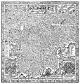
Tirolische Landtafeln.jpg 8,256 × 8,704; 31.46 MB
-
Toblach im Atlas Tyrolensis.jpg 785 × 467; 413 KB
-
Wikisouthtyrol.svg 400 × 230; 141 KB
-
Überetsch-Unterland.svg 1,037 × 686; 132 KB
-
Übersichtskarte Lüsner und Rodenecker Alm.pdf 2,627 × 2,125; 18.17 MB
-
Übersichtskarte Südtirol.png 862 × 571; 986 KB

