Category:Maps of South African municipalities with 2016 borders
Jump to navigation
Jump to search
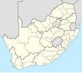
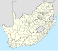
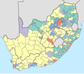
This category contains maps of municipalities in South Africa that show the municipal borders as they are after the municipal election of 3 August 2016.
Subcategories
This category has the following 10 subcategories, out of 10 total.
N
Media in category "Maps of South African municipalities with 2016 borders"
The following 10 files are in this category, out of 10 total.
-
Afrique du sud 2019-par circonscription.svg 809 × 709; 2.39 MB
-
Map of South Africa with municipal borders (2016).svg 809 × 709; 965 KB
-
Map of the administrative geography of South Africa 2018.svg 3,179 × 2,245; 2.21 MB
-
Map of the administrative geography of South Africa 2021.svg 3,179 × 2,245; 1.63 MB
-
Map of the metropolitan municipalities of South Africa (2016).svg 809 × 709; 826 KB
-
South Africa districts 2016 blank.svg 809 × 709; 1.21 MB
-
South Africa municipalities 2016 blank simplified.svg 809 × 709; 281 KB
-
South Africa municipalities 2016 blank.svg 809 × 709; 1.81 MB
-
South Africa municipalities MIIF classification.svg 809 × 709; 1.84 MB
-
South African municipalities by language.svg 809 × 709; 1.81 MB


