Category:Maps of Solunto
Jump to navigation
Jump to search
Wikimedia category | |||||
| Upload media | |||||
| Instance of | |||||
|---|---|---|---|---|---|
| Category combines topics | |||||
| Soluntum | |||||
ancient city on the northern coast of Sicily | |||||
| Instance of |
| ||||
| Location | Santa Flavia, Metropolitan City of Palermo, Sicily, Italy | ||||
| Street address |
| ||||
| Heritage designation | |||||
| Area |
| ||||
| Visitors per year |
| ||||
| official website | |||||
 | |||||
Media in category "Maps of Solunto"
The following 17 files are in this category, out of 17 total.
-
Map of ancient Soluntum.jpg 2,471 × 3,004; 369 KB
-
Soluntum plan italiano.jpg 2,471 × 3,004; 334 KB
-
Urbanistic map of Solunto.jpg 1,913 × 2,602; 4.34 MB
-
Casa delle ghirlande, solunto.jpg 3,401 × 2,323; 291 KB
-
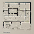
Casa di leda plan.jpg 2,029 × 2,354; 211 KB
-
Mappa area sacra Solunto.jpg 2,249 × 2,241; 2.5 MB
-
Mappa della casa del cerchio.jpg 1,323 × 1,144; 1,018 KB
-
Mappa della casa delle maschere.jpg 1,491 × 2,314; 1.87 MB
-
Mappa della casa di Arpocrate.jpg 1,933 × 2,227; 2.42 MB
-
Mappa della casa di Leda.jpg 1,364 × 1,784; 1.31 MB
-
Mappa ginnasium Solunto.jpg 2,261 × 1,293; 2.63 MB
-
Mappa unità abitative solunto.jpg 2,723 × 1,813; 3.04 MB
-
Planimetria delle terme di Solunto.jpg 2,958 × 1,419; 4 MB
-
Schema del bouleterion di Solunto.jpg 1,639 × 1,648; 2.58 MB
-
Schema del teatro di Solunto.jpg 2,282 × 2,496; 5.96 MB
-
Schema dello stoa di Solunto.jpg 2,738 × 1,883; 3.2 MB
-
Solunto bath, plam.jpg 1,317 × 1,971; 115 KB


