Category:Maps of Soacha
Jump to navigation
Jump to search
Wikimedia category | |||||
| Upload media | |||||
| Instance of | |||||
|---|---|---|---|---|---|
| Category combines topics | |||||
| Soacha | |||||
municipality of Colombia in Cundinamarca | |||||
| Instance of | |||||
| Location |
| ||||
| Legislative body |
| ||||
| Head of government |
| ||||
| Language of work or name | |||||
| Founded by |
| ||||
| Inception |
| ||||
| Population |
| ||||
| Area |
| ||||
| Elevation above sea level |
| ||||
| official website | |||||
 | |||||
Media in category "Maps of Soacha"
The following 20 files are in this category, out of 20 total.
-
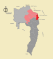
Ciudadela Sucre.png 686 × 773; 51 KB
-
Comuna 1 Compartir -Barrios.png 961 × 738; 204 KB
-
Comuna 1 Compartir.png 686 × 773; 51 KB
-
Comuna 2 Soacha Central.png 686 × 773; 51 KB
-
Comuna 3 La Despensa - Barrios.png 973 × 732; 157 KB
-
Comuna 3 La Despensa.png 686 × 773; 50 KB
-
Comuna 4 Cazucá.png 686 × 773; 51 KB
-
Comuna 5 San Mateo.png 686 × 773; 51 KB
-
Comuna 6 San Humberto.png 686 × 773; 50 KB
-
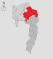
Comunas Urbanas de Soacha.png 670 × 753; 30 KB
-
Corredor Bogotá Soacha.png 1,117 × 888; 284 KB
-
Corregimiento 1 Sur - Valle del Río Soacha.png 670 × 753; 36 KB
-
Corregimiento 2 Norte - Valle del Río Bogotá.png 670 × 753; 37 KB
-
El Charquito.png 686 × 773; 50 KB
-
Hidrografía suachuna.png 682 × 769; 88 KB
-
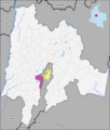
Location of Soacha.png 2,382 × 2,801; 216 KB
-
MunsCundinamarca Soacha.png 2,198 × 2,130; 4.63 MB
-
Soacha administrativa gris.png 670 × 753; 35 KB
-
Soacha vial (2).png 688 × 773; 125 KB
-
Soacha, división administrativa.png 685 × 773; 317 KB


