Category:Maps of Sheba
Jump to navigation
Jump to search
Wikimedia category | |||||
| Upload media | |||||
| Instance of | |||||
|---|---|---|---|---|---|
| Category combines topics | |||||
| Sheba | |||||
Ancient South Arabian kingdom mentioned in multiple religious texts | |||||
| Instance of | |||||
| Location |
| ||||
| Capital | |||||
| Basic form of government | |||||
| Official language | |||||
| Inception |
| ||||
| Dissolved, abolished or demolished date |
| ||||
| Replaced by | |||||
 | |||||
Media in category "Maps of Sheba"
The following 26 files are in this category, out of 26 total.
-
Africa in 400 BC.jpg 361 × 331; 28 KB
-
AxumYElSurDeArabiaHaciaEl230-pt.svg 632 × 456; 33 KB
-
AxumYElSurDeArabiaHaciaEl230-ru.svg 674 × 486; 35 KB
-
AxumYElSurDeArabiaHaciaEl230.svg 622 × 461; 396 KB
-
EthioYemenCities.jpg 771 × 572; 62 KB
-
Hadramawt 400 BC.jpg 1,660 × 1,100; 1.14 MB
-
Jemeno en la jaro -100.svg 1,500 × 1,400; 177 KB
-
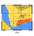
Karib'il Watar map1.svg 1,475 × 1,557; 186 KB
-
Kingdom of Axum map.png 1,242 × 1,359; 261 KB
-
Kush-400aC.jpg 361 × 331; 114 KB
-
Kush-591aC.png 361 × 331; 260 KB
-
Map of Aksum and South Arabia ca. 230 AD-ar.jpg 632 × 456; 59 KB
-
Map of Aksum and South Arabia ca. 230 AD-HE.jpg 632 × 456; 45 KB
-
Map of Aksum and South Arabia ca. 230 AD.jpg 632 × 456; 47 KB
-
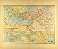
Map of the Ancient Near East.jpg 3,540 × 2,938; 2.34 MB
-
MapHymiariteKingdom.jpg 1,077 × 911; 219 KB
-
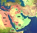
Middle East Shem-Ham-ar.jpg 1,333 × 1,193; 150 KB
-
Middle East Shem-Ham-he.jpg 1,000 × 895; 477 KB
-
Middle East Shem-Ham.jpg 1,000 × 895; 823 KB
-
Sabaean Kingdom.png 918 × 1,038; 24 KB
-
Yaman-he.png 730 × 609; 88 KB
-
Yemen 100 BC hu.png 1,102 × 978; 189 KB
-
Yemen 100 BC-es.svg 1,600 × 1,493; 384 KB
-
Yemen 100 BC-pt.svg 1,600 × 1,493; 384 KB
-
Yemen 100 BC.svg 1,500 × 1,400; 188 KB
-
إنتشار أبناء إبراهيم بحسب التوراة.png 1,043 × 803; 122 KB


