Category:Maps of Sedan (Ardennes)
Jump to navigation
Jump to search
Wikimedia category | |||||
| Upload media | |||||
| Instance of | |||||
|---|---|---|---|---|---|
| Category combines topics | |||||
| Sedan | |||||
commune in Ardennes, France | |||||
| Instance of | |||||
| Location |
| ||||
| Located in or next to body of water | |||||
| Inception |
| ||||
| Population |
| ||||
| Area |
| ||||
| Elevation above sea level |
| ||||
| Different from | |||||
| official website | |||||
 | |||||
Subcategories
This category has only the following subcategory.
M
- Maps of the battle of Sedan (26 F)
Media in category "Maps of Sedan (Ardennes)"
The following 14 files are in this category, out of 14 total.
-
08 ARDENNES carte grille communale densite INSEE.png 3,507 × 2,480; 3.06 MB
-
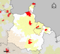
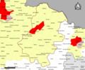
08-AAV2020-Sedan.png 3,519 × 3,197; 1.97 MB
-
08-Sedan-AAV2020.png 3,519 × 2,930; 1.47 MB
-
08409-Sedan-Hydro.jpeg 5,846 × 4,133; 2.8 MB
-
08409-Sedan-Sols.png 3,270 × 2,598; 3.4 MB
-
21 la citadelle de Sedan Davanne-Chappier.jpg 1,260 × 876; 501 KB
-
Les Souverainetez de Sedan et de Raucourt et la prevosté de Doncheri - btv1b59730208.jpg 6,181 × 4,741; 3.72 MB
-
Map commune FR insee code 08409.png 756 × 605; 53 KB
-
Map of the fortress of Sedan (1714).jpg 13,477 × 11,067; 26.9 MB
-
Sedan 1665 1554810.jpg 7,909 × 2,002; 11.7 MB
-
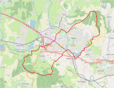
Sedan OSM 01.png 859 × 662; 295 KB
-
Sedan OSM 02.png 859 × 662; 604 KB
-
Sedan plan XVIIIe 1554769.jpg 5,197 × 3,415; 11.71 MB


