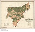
Category:Maps of Schopfheim
Jump to navigation
Jump to search
Pages in category "Maps of Schopfheim"
This category contains only the following page.
Media in category "Maps of Schopfheim"
The following 28 files are in this category, out of 28 total.
-
Gemarkung Eichen.jpg 4,325 × 4,029; 991 KB
-
Gemarkung Enkenstein 1786.jpg 5,345 × 4,231; 3.69 MB
-
Gemarkung Enkenstein Renovationsplan.jpg 4,185 × 2,982; 1.78 MB
-
Gemarkung Hausen Enkenstein.jpg 4,384 × 4,069; 1.27 MB
-
Gemarkung Fahrnau und Hägelberg.jpg 5,343 × 4,254; 3.53 MB
-
Gemarkung Hausen Fahrnau.jpg 2,000 × 1,461; 347 KB
-
Gemarkung Schopfheim.jpg 5,342 × 4,214; 3.47 MB
-
Gemarkung Gersbach 1776.jpg 5,337 × 4,267; 4.09 MB
-
Gemarkung Gersbach.jpg 4,449 × 4,093; 1.67 MB
-
Gemarkung Raitbach-Kürnberg 1784.jpg 5,283 × 4,171; 3.09 MB
-
Gemarkung Enkenstein-Langenau-Wieslet.jpg 5,357 × 4,169; 3.03 MB
-
Gemarkung Langenau.jpg 4,350 × 4,008; 1.01 MB
-
Gemarkung Raitbach-Kürnberg 1882.jpg 4,289 × 3,980; 1.57 MB
-
Gemarkung Raitbach.jpg 5,314 × 4,256; 3.38 MB
-
Schopfheim in LÖ.png 299 × 299; 5 KB
-
Schopfheim in LÖ.svg 540 × 540; 460 KB
-
Stadt Schopfheim und Ortsteile - OT Eichen.png 1,500 × 1,232; 146 KB
-
Stadt Schopfheim und Ortsteile - OT Enkenstein.png 1,500 × 1,232; 149 KB
-
Stadt Schopfheim und Ortsteile - OT Fahrnau.png 1,500 × 1,232; 148 KB
-
Stadt Schopfheim und Ortsteile - OT Gersbach.png 1,500 × 1,232; 156 KB
-
Stadt Schopfheim und Ortsteile - OT Kürnberg.png 1,500 × 1,232; 142 KB
-
Stadt Schopfheim und Ortsteile - OT Langenau.png 1,500 × 1,232; 150 KB
-
Stadt Schopfheim und Ortsteile - OT Raitbach.png 1,500 × 1,232; 150 KB
-
Stadt Schopfheim und Ortsteile - OT Wiechs.png 1,500 × 1,232; 148 KB
-
Stadt Schopfheim und Ortsteile.png 1,500 × 1,232; 141 KB
-
Gemarkung Wiechs.jpg 5,382 × 4,256; 2.96 MB


