Category:Maps of Santa Cruz (Madeira)
Jump to navigation
Jump to search
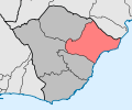
English: Pictures of maps of Santa Cruz (Madeira), a municipality in the east of Madeira an island of Portugal
Subcategories
This category has the following 5 subcategories, out of 5 total.
- Maps of Camacha (3 F)
- Maps of Caniço (2 F)
*
Media in category "Maps of Santa Cruz (Madeira)"
The following 8 files are in this category, out of 8 total.
-
Districts in Madeira.JPG 1,086 × 704; 54 KB
-
Divisão da freguesia de Santo António da Serra.png 773 × 527; 540 KB
-
Ilha da madeira municípios com LOCODE.png 362 × 235; 68 KB
-
Kreis Santa Cruz 2020.png 2,500 × 2,142; 489 KB
-
LocalSantaCruz.png 182 × 140; 3 KB
-
Map-santacruz.png 183 × 140; 4 KB
-
Okresy ostrova Madeira.png 1,086 × 704; 520 KB
-
SCZ - Santa Cruz.svg 235 × 196; 230 KB


