Category:Maps of Saint-Nazaire (Loire-Atlantique)
Jump to navigation
Jump to search
Wikimedia category | |||||
| Upload media | |||||
| Instance of | |||||
|---|---|---|---|---|---|
| Category combines topics | |||||
| Saint-Nazaire | |||||
commune in Loire-Atlantique, France | |||||
| Pronunciation audio | |||||
| Instance of | |||||
| Named after | |||||
| Location | |||||
| Located in or next to body of water | |||||
| Head of government |
| ||||
| Population |
| ||||
| Area |
| ||||
| Elevation above sea level |
| ||||
| Different from | |||||
| official website | |||||
 | |||||
Subcategories
This category has only the following subcategory.
Media in category "Maps of Saint-Nazaire (Loire-Atlantique)"
The following 14 files are in this category, out of 14 total.
-
44 LOIRE-ATLANTIQUE carte grille communale densite INSEE.png 3,507 × 2,480; 2.42 MB
-
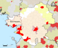
44-AAV2020-Saint-Nazaire.png 3,519 × 2,930; 1.62 MB
-
44-Saint-Nazaire-AAV2020.png 3,519 × 2,930; 1.18 MB
-
Canton de St-Nazaire(Position).png 418 × 314; 38 KB
-
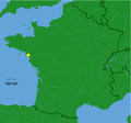
FranceLoireSaintNazaire.png 100 × 97; 5 KB
-
Location Saint-Nazaire.svg 400 × 320; 12 KB
-
Map commune FR insee code 44184.png 756 × 605; 97 KB
-
Map Saint-Nazaire submarine base location.jpg 2,178 × 1,826; 1.17 MB
-
Map Saint-Nazaire.jpg 2,178 × 1,826; 2.4 MB
-
Port de Saint-Nazaire - 1942.svg 512 × 673; 1.42 MB
-
Saint-Nazaire 1941.png 1,638 × 1,176; 753 KB
-
Saint-Nazaire dot.png 1,804 × 1,689; 164 KB
-
Saint-Nazaire OSM 01.png 989 × 825; 458 KB
-
Saint-Nazaire OSM 02.png 989 × 825; 760 KB


