Category:Maps of Saint-Geours-d'Auribat
Jump to navigation
Jump to search
Media in category "Maps of Saint-Geours-d'Auribat"
The following 5 files are in this category, out of 5 total.
-
 40260-Saint-Geours-d'Auribat-argile.jpg 3,057 × 2,480; 507 KB
-
 40260-Saint-Geours-d'Auribat-Sols.png 3,270 × 2,598; 1.84 MB
-
 40260-Saint-Geours-d'Auribat-ZNIEFF1.png 4,692 × 3,307; 3.78 MB
-
 40260-Saint-Geours-d'Auribat-ZNIEFF2.png 5,866 × 4,133; 5.11 MB
-
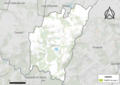
 Map commune FR insee code 40260.png 756 × 605; 31 KB


